

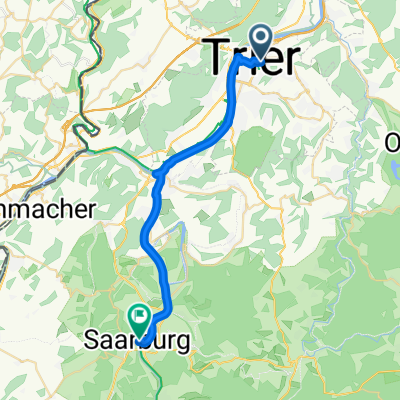
Mosel Radweg Day 3- Final
A cycling route starting in Trier, Rhineland-Palatinate, Germany.
Overview
About this route
Day 3 BfCiC Mosel radweg
(cloned from route 819627)- -:--
- Duration
- 122.1 km
- Distance
- 511 m
- Ascent
- 171 m
- Descent
- ---
- Avg. speed
- ---
- Max. altitude
Route highlights
Points of interest along the route
Point of interest after 28 km
Emergency loo stop at Mehring public toilets
Point of interest after 40.4 km
Morning stop at Leiwen (car park & tourist office)

Point of interest after 75.7 km
Lunch Stop at Zeltingen

Point of interest after 92.4 km
Afternoon stop at Trarbach.
Point of interest after 111.5 km
End of ride day at Zell. Toilet close to coach pick up point

Point of interest after 122.1 km
Overnight at Hotel Fortuna Lautzenhausen
Continue with Bikemap
Use, edit, or download this cycling route
You would like to ride Mosel Radweg Day 3- Final or customize it for your own trip? Here is what you can do with this Bikemap route:
Free features
- Save this route as favorite or in collections
- Copy & plan your own version of this route
- Split it into stages to create a multi-day tour
- Sync your route with Garmin or Wahoo
Premium features
Free trial for 3 days, or one-time payment. More about Bikemap Premium.
- Navigate this route on iOS & Android
- Export a GPX / KML file of this route
- Create your custom printout (try it for free)
- Download this route for offline navigation
Discover more Premium features.
Get Bikemap PremiumFrom our community
Other popular routes starting in Trier
 2. Etappe - Graf-Siegfried-Straße, Saarburg nach Heinertstraße, Mettlach
- Distance
- 24.3 km
- Ascent
- 166 m
- Descent
- 139 m
- Location
- Trier, Rhineland-Palatinate, Germany
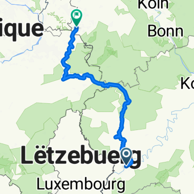
 Trier - Koblenz
- Distance
- 190.9 km
- Ascent
- 267 m
- Descent
- 331 m
- Location
- Trier, Rhineland-Palatinate, Germany
 TRIER-BERNKASTEL KUES
- Distance
- 68.9 km
- Ascent
- 188 m
- Descent
- 206 m
- Location
- Trier, Rhineland-Palatinate, Germany
 Bahnhofsplatz nach Domhof
- Distance
- 231.7 km
- Ascent
- 3,744 m
- Descent
- 3,707 m
- Location
- Trier, Rhineland-Palatinate, Germany
 Trier Stadtrunde
- Distance
- 8 km
- Ascent
- 28 m
- Descent
- 29 m
- Location
- Trier, Rhineland-Palatinate, Germany
 Sonntags durch den Gillenbach
- Distance
- 28 km
- Ascent
- 487 m
- Descent
- 487 m
- Location
- Trier, Rhineland-Palatinate, Germany
 Augustiner Tour 2016 Etappe 1
- Distance
- 70.5 km
- Ascent
- 641 m
- Descent
- 328 m
- Location
- Trier, Rhineland-Palatinate, Germany
 2018 Trier - Luxemburg - Laon - Amiens - Caen - Le Mont-Saint-Michel - St.Malo - Brest - Nantes
- Distance
- 1,877.5 km
- Ascent
- 1,181 m
- Descent
- 1,299 m
- Location
- Trier, Rhineland-Palatinate, Germany
Open it in the app