

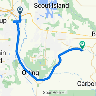
Sumner,Mud Mtn.Dam
A cycling route starting in Sumner, Washington, United States.
Overview
About this route
Tour out to Mud Mtn Dam
- -:--
- Duration
- 100.1 km
- Distance
- 485 m
- Ascent
- 485 m
- Descent
- ---
- Avg. speed
- ---
- Max. altitude
Route quality
Waytypes & surfaces along the route
Waytypes
Road
31 km
(31 %)
Cycleway
29 km
(29 %)
Surfaces
Paved
54 km
(54 %)
Asphalt
54 km
(54 %)
Undefined
46 km
(46 %)
Continue with Bikemap
Use, edit, or download this cycling route
You would like to ride Sumner,Mud Mtn.Dam or customize it for your own trip? Here is what you can do with this Bikemap route:
Free features
- Save this route as favorite or in collections
- Copy & plan your own version of this route
- Split it into stages to create a multi-day tour
- Sync your route with Garmin or Wahoo
Premium features
Free trial for 3 days, or one-time payment. More about Bikemap Premium.
- Navigate this route on iOS & Android
- Export a GPX / KML file of this route
- Create your custom printout (try it for free)
- Download this route for offline navigation
Discover more Premium features.
Get Bikemap PremiumFrom our community
Other popular routes starting in Sumner
 Route to Fryar Avenue 1116, Sumner
- Distance
- 30.7 km
- Ascent
- 46 m
- Descent
- 27 m
- Location
- Sumner, Washington, United States
 Sumner to South Prairie
- Distance
- 26 km
- Ascent
- 134 m
- Descent
- 20 m
- Location
- Sumner, Washington, United States
 Recovered Route
- Distance
- 27.6 km
- Ascent
- 3 m
- Descent
- 14 m
- Location
- Sumner, Washington, United States
 5/17 after work
- Distance
- 81.8 km
- Ascent
- 273 m
- Descent
- 262 m
- Location
- Sumner, Washington, United States
 Restful route in Puyallup
- Distance
- 19.2 km
- Ascent
- 144 m
- Descent
- 144 m
- Location
- Sumner, Washington, United States
 Fryar Avenue 1116, Sumner to Fryar Avenue 1006, Sumner
- Distance
- 38.5 km
- Ascent
- 26 m
- Descent
- 30 m
- Location
- Sumner, Washington, United States
 Sumner,Mud Mtn.Dam
- Distance
- 100.1 km
- Ascent
- 485 m
- Descent
- 485 m
- Location
- Sumner, Washington, United States
 1201 Valley Ave E, Sumner to 282 SR-410, Buckley
- Distance
- 22 km
- Ascent
- 260 m
- Descent
- 60 m
- Location
- Sumner, Washington, United States
Open it in the app