

Tour durch Stapelholm CLONED FROM ROUTE 305486
A cycling route starting in Süderstapel, Schleswig-Holstein, Germany.
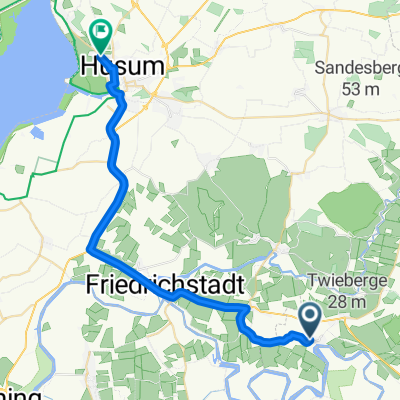
Overview
About this route
This route represents a trail through almost all of Stapelholm as well as a part of Dithmarschen. We like to ride it on our road bikes, as these are very well-developed routes that go along little-traveled roads or run mainly on country paths. The paths are paved or concrete.
- -:--
- Duration
- 63.7 km
- Distance
- 103 m
- Ascent
- 113 m
- Descent
- ---
- Avg. speed
- 26 m
- Max. altitude
Route quality
Waytypes & surfaces along the route
Waytypes
Quiet road
23.6 km
(37 %)
Track
11.5 km
(18 %)
Surfaces
Paved
28 km
(44 %)
Asphalt
22.9 km
(36 %)
Paved (undefined)
5.1 km
(8 %)
Undefined
35.7 km
(56 %)
Continue with Bikemap
Use, edit, or download this cycling route
You would like to ride Tour durch Stapelholm CLONED FROM ROUTE 305486 or customize it for your own trip? Here is what you can do with this Bikemap route:
Free features
- Save this route as favorite or in collections
- Copy & plan your own version of this route
- Sync your route with Garmin or Wahoo
Premium features
Free trial for 3 days, or one-time payment. More about Bikemap Premium.
- Navigate this route on iOS & Android
- Export a GPX / KML file of this route
- Create your custom printout (try it for free)
- Download this route for offline navigation
Discover more Premium features.
Get Bikemap PremiumFrom our community
Other popular routes starting in Süderstapel
 Norderstapel nach Neumünster-Flugplatz
- Distance
- 76.6 km
- Ascent
- 106 m
- Descent
- 92 m
- Location
- Süderstapel, Schleswig-Holstein, Germany
 Süderstapel_Husum
- Distance
- 28.1 km
- Ascent
- 24 m
- Descent
- 31 m
- Location
- Süderstapel, Schleswig-Holstein, Germany
 BC SH 2019 Norderstapel Grüner Kamp
- Distance
- 38.8 km
- Ascent
- 35 m
- Descent
- 36 m
- Location
- Süderstapel, Schleswig-Holstein, Germany
 bergenhusen
- Distance
- 21.9 km
- Ascent
- 84 m
- Descent
- 84 m
- Location
- Süderstapel, Schleswig-Holstein, Germany
 Süderstape--Hohnerfähre-Bergenhusen-Süderstapel
- Distance
- 50.9 km
- Ascent
- 88 m
- Descent
- 86 m
- Location
- Süderstapel, Schleswig-Holstein, Germany
 Stapel-Brunsbuttel
- Distance
- 70.3 km
- Ascent
- 256 m
- Descent
- 258 m
- Location
- Süderstapel, Schleswig-Holstein, Germany
 Strandstraße 31, Schleswig-Flensburg nach Strandstraße 33, Schleswig-Flensburg
- Distance
- 42 km
- Ascent
- 85 m
- Descent
- 86 m
- Location
- Süderstapel, Schleswig-Holstein, Germany
 Friedhofstraße 16, Schleswig-Flensburg nach Hauptstraße 4, Wiemerstedt
- Distance
- 17.7 km
- Ascent
- 16 m
- Descent
- 26 m
- Location
- Süderstapel, Schleswig-Holstein, Germany
Open it in the app