

Kraichgau Triathlon S-Distanz
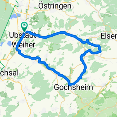
A cycling route starting in Ubstadt-Weiher, Baden-Wurttemberg, Germany.
Overview
About this route
Bike course for the Kraichgau Triathlon 2008 (S-distance)
(cloned from route 36774)
- -:--
- Duration
- 40.4 km
- Distance
- 394 m
- Ascent
- 371 m
- Descent
- ---
- Avg. speed
- ---
- Max. altitude

Route quality
Waytypes & surfaces along the route
Waytypes
Quiet road
9.3 km
(23 %)
Road
6.9 km
(17 %)
Surfaces
Paved
39.2 km
(97 %)
Asphalt
38.4 km
(95 %)
Paved (undefined)
0.4 km
(1 %)
Continue with Bikemap
Use, edit, or download this cycling route
You would like to ride Kraichgau Triathlon S-Distanz or customize it for your own trip? Here is what you can do with this Bikemap route:
Free features
- Save this route as favorite or in collections
- Copy & plan your own version of this route
- Sync your route with Garmin or Wahoo
Premium features
Free trial for 3 days, or one-time payment. More about Bikemap Premium.
- Navigate this route on iOS & Android
- Export a GPX / KML file of this route
- Create your custom printout (try it for free)
- Download this route for offline navigation
Discover more Premium features.
Get Bikemap PremiumFrom our community
Other popular routes starting in Ubstadt-Weiher
 Challenge Kraichgau 2009
- Distance
- 89.3 km
- Ascent
- 959 m
- Descent
- 875 m
- Location
- Ubstadt-Weiher, Baden-Wurttemberg, Germany
 Weiher - Kraichgau - Weiher
- Distance
- 47.6 km
- Ascent
- 453 m
- Descent
- 444 m
- Location
- Ubstadt-Weiher, Baden-Wurttemberg, Germany
 Kleine Kraichgaurunde
- Distance
- 27.8 km
- Ascent
- 475 m
- Descent
- 490 m
- Location
- Ubstadt-Weiher, Baden-Wurttemberg, Germany
 Challenge Kraichgau Triathlon Festival
- Distance
- 90.2 km
- Ascent
- 641 m
- Descent
- 619 m
- Location
- Ubstadt-Weiher, Baden-Wurttemberg, Germany
 Flache Rundtour Stettfeld-Münzesheim-Menzingen-Odenheim
- Distance
- 40.1 km
- Ascent
- 154 m
- Descent
- 156 m
- Location
- Ubstadt-Weiher, Baden-Wurttemberg, Germany
 Rund um den Schmallenberg
- Distance
- 20.1 km
- Ascent
- 148 m
- Descent
- 151 m
- Location
- Ubstadt-Weiher, Baden-Wurttemberg, Germany
 Ubstadt (Kraichtal) zum Wasserscholss Menzingen am Kraichbach entlang
- Distance
- 17.7 km
- Ascent
- 73 m
- Descent
- 17 m
- Location
- Ubstadt-Weiher, Baden-Wurttemberg, Germany
 Kraichtalrunde
- Distance
- 52.9 km
- Ascent
- 414 m
- Descent
- 414 m
- Location
- Ubstadt-Weiher, Baden-Wurttemberg, Germany
Open it in the app