

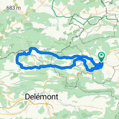
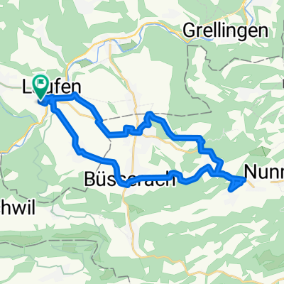
Roc de Courroux
A cycling route starting in Laufen, Basel-Landschaft, Switzerland.
Overview
About this route
not exactly an easy route uphill or downhill, typical Jura trails. The climb to Stürmenchopf can be skipped if you want, going uphill only by pushing the bike, downhill very technically demanding due to very tight switchbacks.
between Ober Fringeli and Retemberg, a push section or two cannot be excluded!!!
but the descent from Roc de Courroux is absolutely top-notch
- -:--
- Duration
- 25.3 km
- Distance
- 983 m
- Ascent
- 930 m
- Descent
- ---
- Avg. speed
- ---
- Max. altitude
Continue with Bikemap
Use, edit, or download this cycling route
You would like to ride Roc de Courroux or customize it for your own trip? Here is what you can do with this Bikemap route:
Free features
- Save this route as favorite or in collections
- Copy & plan your own version of this route
- Sync your route with Garmin or Wahoo
Premium features
Free trial for 3 days, or one-time payment. More about Bikemap Premium.
- Navigate this route on iOS & Android
- Export a GPX / KML file of this route
- Create your custom printout (try it for free)
- Download this route for offline navigation
Discover more Premium features.
Get Bikemap PremiumFrom our community
Other popular routes starting in Laufen
 Easy1
Easy1- Distance
- 27.1 km
- Ascent
- 672 m
- Descent
- 677 m
- Location
- Laufen, Basel-Landschaft, Switzerland
 Roc de Courroux
- Distance
- 25.3 km
- Ascent
- 983 m
- Descent
- 930 m
- Location
- Laufen, Basel-Landschaft, Switzerland
 Laufen - Röschenz - Dittinger Flugfeld - Laufen
- Distance
- 10.7 km
- Ascent
- 238 m
- Descent
- 238 m
- Location
- Laufen, Basel-Landschaft, Switzerland
 14.01.2020 Sportliche Route in Laufen - March
- Distance
- 30.6 km
- Ascent
- 373 m
- Descent
- 373 m
- Location
- Laufen, Basel-Landschaft, Switzerland
 Laufen-Löwenburg
- Distance
- 42.1 km
- Ascent
- 641 m
- Descent
- 640 m
- Location
- Laufen, Basel-Landschaft, Switzerland
 19.01.2020 Huggerwald
- Distance
- 18.3 km
- Ascent
- 321 m
- Descent
- 320 m
- Location
- Laufen, Basel-Landschaft, Switzerland
 Gemütliche Route in Laufen
- Distance
- 28.3 km
- Ascent
- 550 m
- Descent
- 553 m
- Location
- Laufen, Basel-Landschaft, Switzerland
 01.09.2020 Gilgenberg
- Distance
- 24.2 km
- Ascent
- 335 m
- Descent
- 335 m
- Location
- Laufen, Basel-Landschaft, Switzerland
Open it in the app