

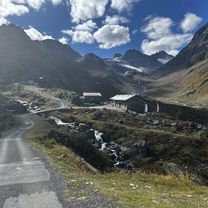
Silvretta-Tour
A cycling route starting in Galtür, Tyrol, Austria.
Overview
About this route
Galtür-Partenen-Galtür via the Silvretta High Alpine Road
- -:--
- Duration
- 49.8 km
- Distance
- 1,390 m
- Ascent
- 1,389 m
- Descent
- ---
- Avg. speed
- ---
- Max. altitude

Continue with Bikemap
Use, edit, or download this cycling route
You would like to ride Silvretta-Tour or customize it for your own trip? Here is what you can do with this Bikemap route:
Free features
- Save this route as favorite or in collections
- Copy & plan your own version of this route
- Sync your route with Garmin or Wahoo
Premium features
Free trial for 3 days, or one-time payment. More about Bikemap Premium.
- Navigate this route on iOS & Android
- Export a GPX / KML file of this route
- Create your custom printout (try it for free)
- Download this route for offline navigation
Discover more Premium features.
Get Bikemap PremiumFrom our community
Other popular routes starting in Galtür
 Gravel Austria, Etappe Vorarlberg
- Distance
- 260.5 km
- Ascent
- 5,896 m
- Descent
- 6,223 m
- Location
- Galtür, Tyrol, Austria
 Galtür
- Distance
- 50.5 km
- Ascent
- 997 m
- Descent
- 995 m
- Location
- Galtür, Tyrol, Austria
 Gravel Austria, Etappe Vorarlberg
- Distance
- 260.5 km
- Ascent
- 5,896 m
- Descent
- 6,223 m
- Location
- Galtür, Tyrol, Austria
 Zeinisjoch Variante
- Distance
- 2.7 km
- Ascent
- 232 m
- Descent
- 82 m
- Location
- Galtür, Tyrol, Austria
 13-ROUTE_2022-Heilbronner_Huette-St-Anton
- Distance
- 20.9 km
- Ascent
- 414 m
- Descent
- 1,383 m
- Location
- Galtür, Tyrol, Austria
 Galtür, Galtür nach Galtür
- Distance
- 10.6 km
- Ascent
- 665 m
- Descent
- 77 m
- Location
- Galtür, Tyrol, Austria
 Silvretta-Tour
- Distance
- 49.8 km
- Ascent
- 1,390 m
- Descent
- 1,389 m
- Location
- Galtür, Tyrol, Austria
 MTB_2018_Ischgl_3Seen_DD
- Distance
- 36.9 km
- Ascent
- 1,318 m
- Descent
- 1,316 m
- Location
- Galtür, Tyrol, Austria
Open it in the app