

Runde mit Lauri
A cycling route starting in Ehrenfriedersdorf, Saxony, Germany.
Overview
About this route
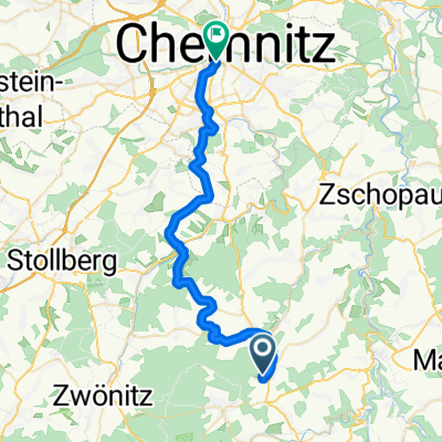
Ehrenfriedersdorf via the Geyrischw pond to Burkhardtsdorf and back via Dittersdorf to Ehrenfriedersdorf (cloned from route 3058911)
- -:--
- Duration
- 54.4 km
- Distance
- 673 m
- Ascent
- 673 m
- Descent
- ---
- Avg. speed
- ---
- Max. altitude
Route quality
Waytypes & surfaces along the route
Waytypes
Track
20.1 km
(37 %)
Quiet road
16.9 km
(31 %)
Surfaces
Paved
31.6 km
(58 %)
Unpaved
21.2 km
(39 %)
Asphalt
29.4 km
(54 %)
Gravel
13.1 km
(24 %)
Continue with Bikemap
Use, edit, or download this cycling route
You would like to ride Runde mit Lauri or customize it for your own trip? Here is what you can do with this Bikemap route:
Free features
- Save this route as favorite or in collections
- Copy & plan your own version of this route
- Sync your route with Garmin or Wahoo
Premium features
Free trial for 3 days, or one-time payment. More about Bikemap Premium.
- Navigate this route on iOS & Android
- Export a GPX / KML file of this route
- Create your custom printout (try it for free)
- Download this route for offline navigation
Discover more Premium features.
Get Bikemap PremiumFrom our community
Other popular routes starting in Ehrenfriedersdorf
 Kleine Runde um den Stauweiher
- Distance
- 20.2 km
- Ascent
- 360 m
- Descent
- 360 m
- Location
- Ehrenfriedersdorf, Saxony, Germany
 Moderate Route in teichrute
- Distance
- 31.4 km
- Ascent
- 594 m
- Descent
- 588 m
- Location
- Ehrenfriedersdorf, Saxony, Germany
 ARBEIT
- Distance
- 5.8 km
- Ascent
- 28 m
- Descent
- 138 m
- Location
- Ehrenfriedersdorf, Saxony, Germany
 .....
.....- Distance
- 3.2 km
- Ascent
- 140 m
- Descent
- 22 m
- Location
- Ehrenfriedersdorf, Saxony, Germany
 Runde mit Lauri
- Distance
- 54.4 km
- Ascent
- 673 m
- Descent
- 673 m
- Location
- Ehrenfriedersdorf, Saxony, Germany
 Von Ehrenfriedersdorf nach Dresden
- Distance
- 95.1 km
- Ascent
- 863 m
- Descent
- 1,256 m
- Location
- Ehrenfriedersdorf, Saxony, Germany
 Röhrgrabenlauf - Ehrenfriedersdorf
- Distance
- 34 km
- Ascent
- 326 m
- Descent
- 585 m
- Location
- Ehrenfriedersdorf, Saxony, Germany
 Am Steinbüschel 9, Ehrenfriedersdorf nach Gifthüttenstraße, Sehmatal
- Distance
- 28.2 km
- Ascent
- 575 m
- Descent
- 226 m
- Location
- Ehrenfriedersdorf, Saxony, Germany
Open it in the app