

Mußbach - Böhl - Hochdorf
A cycling route starting in Niederkirchen bei Deidesheim, Rhineland-Palatinate, Germany.
Overview
About this route
TEASI track from 31/05/2015
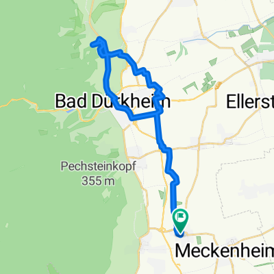
From Niederkirchen via Eidesheim, Ruppertsberg and Mußbach to Haßloch, then over Böhl and Hochdorf-Assenheim through Meckenheim back to Niederkirchen.
- -:--
- Duration
- 27.6 km
- Distance
- 38 m
- Ascent
- 40 m
- Descent
- ---
- Avg. speed
- ---
- Max. altitude

Route quality
Waytypes & surfaces along the route
Waytypes
Track
19 km
(69 %)
Road
4.1 km
(15 %)
Surfaces
Paved
21 km
(76 %)
Unpaved
1.7 km
(6 %)
Asphalt
16 km
(58 %)
Concrete
3.3 km
(12 %)
Continue with Bikemap
Use, edit, or download this cycling route
You would like to ride Mußbach - Böhl - Hochdorf or customize it for your own trip? Here is what you can do with this Bikemap route:
Free features
- Save this route as favorite or in collections
- Copy & plan your own version of this route
- Sync your route with Garmin or Wahoo
Premium features
Free trial for 3 days, or one-time payment. More about Bikemap Premium.
- Navigate this route on iOS & Android
- Export a GPX / KML file of this route
- Create your custom printout (try it for free)
- Download this route for offline navigation
Discover more Premium features.
Get Bikemap PremiumFrom our community
Other popular routes starting in Niederkirchen bei Deidesheim
 Durchs Wachenheimer Tal nach NW
- Distance
- 35.7 km
- Ascent
- 600 m
- Descent
- 583 m
- Location
- Niederkirchen bei Deidesheim, Rhineland-Palatinate, Germany
 Am Weißentsich - Wachenheim
- Distance
- 29.6 km
- Ascent
- 487 m
- Descent
- 487 m
- Location
- Niederkirchen bei Deidesheim, Rhineland-Palatinate, Germany
 Weilach - Freinsheim - Niederkirchen
- Distance
- 39.7 km
- Ascent
- 275 m
- Descent
- 272 m
- Location
- Niederkirchen bei Deidesheim, Rhineland-Palatinate, Germany
 Michaelskapelle - Heidenlöcher - Am Weißenstich
- Distance
- 28.1 km
- Ascent
- 574 m
- Descent
- 574 m
- Location
- Niederkirchen bei Deidesheim, Rhineland-Palatinate, Germany
 Haardt - Weinbiet - Haßloch
- Distance
- 41.3 km
- Ascent
- 506 m
- Descent
- 506 m
- Location
- Niederkirchen bei Deidesheim, Rhineland-Palatinate, Germany
 Mußbach - Böhl - Hochdorf
- Distance
- 27.6 km
- Ascent
- 38 m
- Descent
- 40 m
- Location
- Niederkirchen bei Deidesheim, Rhineland-Palatinate, Germany
 Niederkirchen - Weisenheim am Sand
- Distance
- 44 km
- Ascent
- 113 m
- Descent
- 113 m
- Location
- Niederkirchen bei Deidesheim, Rhineland-Palatinate, Germany
 Niederkirchen - Leistadt
- Distance
- 25.4 km
- Ascent
- 201 m
- Descent
- 198 m
- Location
- Niederkirchen bei Deidesheim, Rhineland-Palatinate, Germany
Open it in the app