Onnion Morzine Onnion
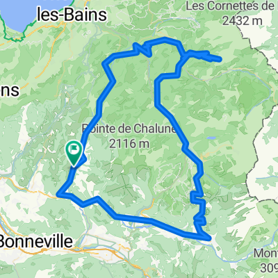
A cycling route starting in Saint-Jeoire, Auvergne-Rh么ne-Alpes, France.
Overview
About this route
Onnion, La Vernaz, Morzine, Les Gets, Taninges, Mieussy, Onnion
- -:--
- Duration
- 85.5 km
- Distance
- 1,179 m
- Ascent
- 1,181 m
- Descent
- ---
- Avg. speed
- ---
- Avg. speed
Route quality
Waytypes & surfaces along the route
Waytypes
Busy road
35.4 km
(41 %)
Road
28.1 km
(33 %)
Surfaces
Paved
60 km
(70 %)
Unpaved
2.1 km
(2 %)
Asphalt
60 km
(70 %)
Gravel
0.8 km
(<1 %)
Continue with Bikemap
Use, edit, or download this cycling route
You would like to ride Onnion Morzine Onnion or customize it for your own trip? Here is what you can do with this Bikemap route:
Free features
- Save this route as favorite or in collections
- Copy & plan your own version of this route
- Split it into stages to create a multi-day tour
- Sync your route with Garmin or Wahoo
Premium features
Free trial for 3 days, or one-time payment. More about Bikemap Premium.
- Navigate this route on iOS & Android
- Export a GPX / KML file of this route
- Create your custom printout (try it for free)
- Download this route for offline navigation
Discover more Premium features.
Get Bikemap PremiumFrom our community
Other popular routes starting in Saint-Jeoire
- Sortie 9
- Distance
- 87.8 km
- Ascent
- 936 m
- Descent
- 936 m
- Location
- Saint-Jeoire, Auvergne-Rh么ne-Alpes, France
- Haute Savoie: St-Jeoire - Onion - Cols de l'Avernas - de Ludran - des Moises - de Cou - de Terramont - de Jambaz
- Distance
- 103.9 km
- Ascent
- 2,250 m
- Descent
- 2,253 m
- Location
- Saint-Jeoire, Auvergne-Rh么ne-Alpes, France
- Onnion Joux Plane
- Distance
- 84.5 km
- Ascent
- 1,699 m
- Descent
- 1,699 m
- Location
- Saint-Jeoire, Auvergne-Rh么ne-Alpes, France
- Onnion Morzine Onnion
- Distance
- 85.5 km
- Ascent
- 1,179 m
- Descent
- 1,181 m
- Location
- Saint-Jeoire, Auvergne-Rh么ne-Alpes, France
- Cevennen Alpen 1995 Etappe 12
- Distance
- 47.4 km
- Ascent
- 631 m
- Descent
- 869 m
- Location
- Saint-Jeoire, Auvergne-Rh么ne-Alpes, France
- onnion joux plane Sixt fer Cheval, Onnio
- Distance
- 94.5 km
- Ascent
- 1,491 m
- Descent
- 1,485 m
- Location
- Saint-Jeoire, Auvergne-Rh么ne-Alpes, France
- 2013 09 08 COG St Jeoire- Areches (via Taninges)
- Distance
- 115.9 km
- Ascent
- 2,695 m
- Descent
- 2,250 m
- Location
- Saint-Jeoire, Auvergne-Rh么ne-Alpes, France
- Haute-Savoie: 91 km: St-Jeoire- Col Joux Plane - Morzine - Col Ramaz - St-Jeoire
- Distance
- 91.2 km
- Ascent
- 2,724 m
- Descent
- 2,720 m
- Location
- Saint-Jeoire, Auvergne-Rh么ne-Alpes, France
Open it in the app