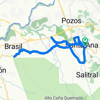
Entrenamiento Salitral Río Oro
- 15.1 km
- 304 m
- 307 m
- Santa Ana, Provincia de San José, Costa Rica
A cycling route starting in Santa Ana, Provincia de San José, Costa Rica.
Overview
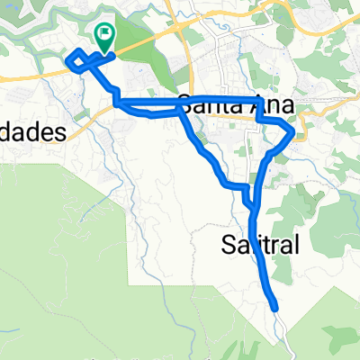
Nice ride. Pay attention to the dangerous descent from km 38 to 42, proceed with caution, many curves and steep gradient.
created this 10 years ago
Route highlights
Descenso muy fuerte hacia Santa Marta, muchas curvas.
Salitrales Punto de reunión, Pulperías. Aproximadamente 2 km antes empieza el lastre
Punto de reunión La Gloria de Puriscal Cruz Roja
Punto de Reunión.
Salida Quebrada Amarilla
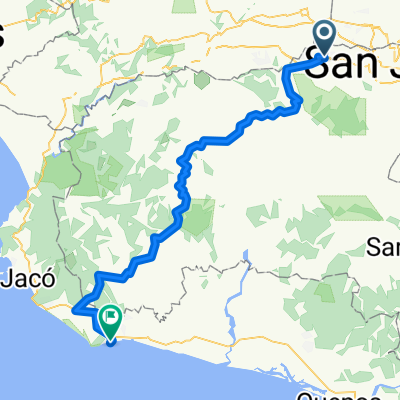
Hotel La Sirena
Continue with Bikemap
You would like to ride Demenride Santa Ana Esterillos or customize it for your own trip? Here is what you can do with this Bikemap route:
Free trial for 3 days, or one-time payment. More about Bikemap Premium.
Discover more Premium features.
Get Bikemap PremiumFrom our community
Open it in the app