Mittenwald - Rottenbuch
- 69.7 km
- 775 m
- 916 m
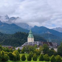
- Mittenwald, Bavaria, Germany
A cycling route starting in Mittenwald, Bavaria, Germany.
Overview
Mittenwald > Bockweg > Buckelwiesenweg > Hochstr. > Finzbachstr. > Wallgauer Str. > Walchenseestr. B11 > Finzstr. > Flößerstr. > Simetsbergstr. > Radweg neben Walchenseestr. B11 bis Obernach > Walchenseeumrundung, allerdings Variante zwischen Sachenbach und Niedernach auf Straße statt auf Uferweg > gleiche Rückfahrt bis Wallgau > Barmsee > Mittenwald
created this 17 years ago
Route quality
Quiet road
18.2 km
28 %
Track
16.2 km
25 %
Paved
49.9 km
(77 %)
Unpaved
10.4 km
(16 %)
Asphalt
49.3 km
76 %
Gravel
3.9 km
6 %
Continue with Bikemap
You would like to ride Mittenwald - Walchenseerunde - Barmsee - Mittenwald or customize it for your own trip? Here is what you can do with this Bikemap route:
Free trial for 3 days, or one-time payment. More about Bikemap Premium.
Discover more Premium features.
Get Bikemap PremiumFrom our community
Open it in the app