

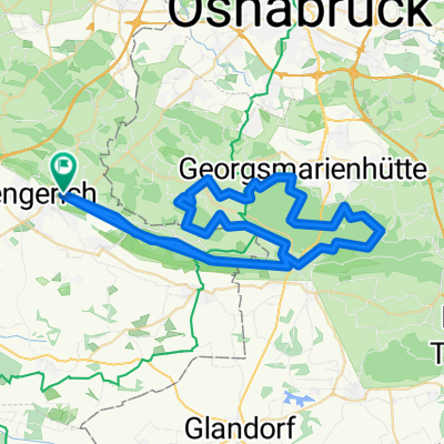
RSV Concordia Lengerich RTF 2015 - 110km
A cycling route starting in Lengerich, North Rhine-Westphalia, Germany.
Overview
About this route
Test
- -:--
- Duration
- 118.2 km
- Distance
- 274 m
- Ascent
- 271 m
- Descent
- ---
- Avg. speed
- ---
- Max. altitude
Route quality
Waytypes & surfaces along the route
Waytypes
Quiet road
66.2 km
(56 %)
Road
23.6 km
(20 %)
Surfaces
Paved
69.7 km
(59 %)
Unpaved
1.2 km
(1 %)
Asphalt
62.6 km
(53 %)
Paved (undefined)
7.1 km
(6 %)
Continue with Bikemap
Use, edit, or download this cycling route
You would like to ride RSV Concordia Lengerich RTF 2015 - 110km or customize it for your own trip? Here is what you can do with this Bikemap route:
Free features
- Save this route as favorite or in collections
- Copy & plan your own version of this route
- Split it into stages to create a multi-day tour
- Sync your route with Garmin or Wahoo
Premium features
Free trial for 3 days, or one-time payment. More about Bikemap Premium.
- Navigate this route on iOS & Android
- Export a GPX / KML file of this route
- Create your custom printout (try it for free)
- Download this route for offline navigation
Discover more Premium features.
Get Bikemap PremiumFrom our community
Other popular routes starting in Lengerich
 Intermezzo Lengerich-Lienen
- Distance
- 16 km
- Ascent
- 265 m
- Descent
- 257 m
- Location
- Lengerich, North Rhine-Westphalia, Germany
 Bocketal und zurück
- Distance
- 25.7 km
- Ascent
- 291 m
- Descent
- 281 m
- Location
- Lengerich, North Rhine-Westphalia, Germany
 Von Lengerich bis Lienen
- Distance
- 19.5 km
- Ascent
- 305 m
- Descent
- 260 m
- Location
- Lengerich, North Rhine-Westphalia, Germany
 Teuto-Runde I
- Distance
- 68.6 km
- Ascent
- 708 m
- Descent
- 667 m
- Location
- Lengerich, North Rhine-Westphalia, Germany
 Teuto-Runde I CLONED FROM ROUTE 290952
- Distance
- 68.7 km
- Ascent
- 568 m
- Descent
- 569 m
- Location
- Lengerich, North Rhine-Westphalia, Germany
 144 04_06_2019_Hellern
- Distance
- 41.6 km
- Ascent
- 316 m
- Descent
- 309 m
- Location
- Lengerich, North Rhine-Westphalia, Germany
 PE1-Olympiade2013
- Distance
- 18.8 km
- Ascent
- 5 m
- Descent
- 17 m
- Location
- Lengerich, North Rhine-Westphalia, Germany
 Lengerich - Bad Iburg - kl. Ahornweg - Bad Iburg - Lengerich
- Distance
- 64.7 km
- Ascent
- 1,257 m
- Descent
- 1,199 m
- Location
- Lengerich, North Rhine-Westphalia, Germany
Open it in the app