

Am Neckar entlang - gegen den Strom.gpx
A cycling route starting in Plochingen, Baden-Wurttemberg, Germany.
Overview
About this route
TEASI track from Plochingen to Tübingen. Cycle path in Plochingen initially gravelled!
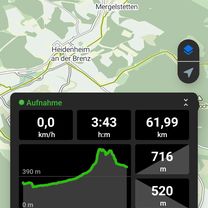
- -:--
- Duration
- 43.8 km
- Distance
- 216 m
- Ascent
- 147 m
- Descent
- ---
- Avg. speed
- ---
- Max. altitude

Route quality
Waytypes & surfaces along the route
Waytypes
Road
8.8 km
(20 %)
Track
7.9 km
(18 %)
Surfaces
Paved
39.4 km
(90 %)
Unpaved
2.6 km
(6 %)
Asphalt
39.4 km
(90 %)
Gravel
1.3 km
(3 %)
Continue with Bikemap
Use, edit, or download this cycling route
You would like to ride Am Neckar entlang - gegen den Strom.gpx or customize it for your own trip? Here is what you can do with this Bikemap route:
Free features
- Save this route as favorite or in collections
- Copy & plan your own version of this route
- Sync your route with Garmin or Wahoo
Premium features
Free trial for 3 days, or one-time payment. More about Bikemap Premium.
- Navigate this route on iOS & Android
- Export a GPX / KML file of this route
- Create your custom printout (try it for free)
- Download this route for offline navigation
Discover more Premium features.
Get Bikemap PremiumFrom our community
Other popular routes starting in Plochingen
 Bahnhof nach Beethovenweg
- Distance
- 75.6 km
- Ascent
- 865 m
- Descent
- 638 m
- Location
- Plochingen, Baden-Wurttemberg, Germany
 Ebersbach
- Distance
- 15.7 km
- Ascent
- 413 m
- Descent
- 341 m
- Location
- Plochingen, Baden-Wurttemberg, Germany
 20160124_111235.gpx
- Distance
- 21.5 km
- Ascent
- 309 m
- Descent
- 378 m
- Location
- Plochingen, Baden-Wurttemberg, Germany
 Bodenseetour 2
- Distance
- 236.9 km
- Ascent
- 2,312 m
- Descent
- 1,973 m
- Location
- Plochingen, Baden-Wurttemberg, Germany
 Schurwald für Anfänger, Katzenbach und Lützelbach
- Distance
- 21.3 km
- Ascent
- 260 m
- Descent
- 257 m
- Location
- Plochingen, Baden-Wurttemberg, Germany
 000_30km_11-Radler_Plochingen-Esslingen
- Distance
- 30.2 km
- Ascent
- 133 m
- Descent
- 150 m
- Location
- Plochingen, Baden-Wurttemberg, Germany
 Große Plochingerrunde
- Distance
- 24.4 km
- Ascent
- 235 m
- Descent
- 235 m
- Location
- Plochingen, Baden-Wurttemberg, Germany
 Lettenäcker-Ebersbach
- Distance
- 31.7 km
- Ascent
- 292 m
- Descent
- 292 m
- Location
- Plochingen, Baden-Wurttemberg, Germany
Open it in the app