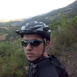
rota 060615
A cycling route starting in Venâncio Aires, Rio Grande do Sul, Brazil.
Overview
About this route
V. Aires, M. Leitão, Vale do Sampaio, following the Sampaio stream to Deodoro, then returning via RS 422 to V. Aires.
- -:--
- Duration
- 62.8 km
- Distance
- 660 m
- Ascent
- 666 m
- Descent
- ---
- Avg. speed
- ---
- Max. altitude
Route quality
Waytypes & surfaces along the route
Waytypes
Quiet road
25.1 km
(40 %)
Road
13.8 km
(22 %)
Surfaces
Paved
22 km
(35 %)
Unpaved
30.1 km
(48 %)
Unpaved (undefined)
27 km
(43 %)
Asphalt
21.4 km
(34 %)
Route highlights
Points of interest along the route
Point of interest after 35.3 km
inicio subida
Point of interest after 38.5 km
pico mais alto da subida 450 m
Continue with Bikemap
Use, edit, or download this cycling route
You would like to ride rota 060615 or customize it for your own trip? Here is what you can do with this Bikemap route:
Free features
- Save this route as favorite or in collections
- Copy & plan your own version of this route
- Sync your route with Garmin or Wahoo
Premium features
Free trial for 3 days, or one-time payment. More about Bikemap Premium.
- Navigate this route on iOS & Android
- Export a GPX / KML file of this route
- Create your custom printout (try it for free)
- Download this route for offline navigation
Discover more Premium features.
Get Bikemap PremiumFrom our community
Other popular routes starting in Venâncio Aires
 Trilha 04 - Monte Belo/Santa Emília
- Distance
- 40.9 km
- Ascent
- 482 m
- Descent
- 470 m
- Location
- Venâncio Aires, Rio Grande do Sul, Brazil
 rota 060615
- Distance
- 62.8 km
- Ascent
- 660 m
- Descent
- 666 m
- Location
- Venâncio Aires, Rio Grande do Sul, Brazil
 Barragem eclusa Bom retiro
- Distance
- 63.4 km
- Ascent
- 198 m
- Descent
- 198 m
- Location
- Venâncio Aires, Rio Grande do Sul, Brazil
 PTO - 03112013 > Desafio Nossa Serra - Ida
- Distance
- 58.8 km
- Ascent
- 995 m
- Descent
- 509 m
- Location
- Venâncio Aires, Rio Grande do Sul, Brazil
 Trilha 02 - Palanque/Estância
- Distance
- 43.9 km
- Ascent
- 361 m
- Descent
- 357 m
- Location
- Venâncio Aires, Rio Grande do Sul, Brazil
 centro,corredor dos rosa,linha Hansel,bela vista
- Distance
- 37.6 km
- Ascent
- 158 m
- Descent
- 170 m
- Location
- Venâncio Aires, Rio Grande do Sul, Brazil
 Trilhe 06 - Terezinha/Mato Leitão
- Distance
- 47.9 km
- Ascent
- 464 m
- Descent
- 464 m
- Location
- Venâncio Aires, Rio Grande do Sul, Brazil
 Centro Venancio, passo do sobrado, vale verde, Balneario Monte Alegre
- Distance
- 57.1 km
- Ascent
- 272 m
- Descent
- 307 m
- Location
- Venâncio Aires, Rio Grande do Sul, Brazil
Open it in the app


