

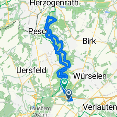
Aachen-Nordkreis-Runde
A cycling route starting in Würselen, North Rhine-Westphalia, Germany.
Overview
About this route
Haaren - Würselen - Alsdorf - Schleiden -
Siersdorf - Baesweiler - Merkstein - Herzogenrath Soers - Haaren- -:--
- Duration
- 48.9 km
- Distance
- 270 m
- Ascent
- 270 m
- Descent
- ---
- Avg. speed
- ---
- Max. altitude
Route quality
Waytypes & surfaces along the route
Waytypes
Quiet road
20.7 km
(42 %)
Track
13 km
(27 %)
Surfaces
Paved
40.1 km
(82 %)
Unpaved
1.1 km
(2 %)
Asphalt
27.9 km
(57 %)
Paving stones
6.8 km
(14 %)
Continue with Bikemap
Use, edit, or download this cycling route
You would like to ride Aachen-Nordkreis-Runde or customize it for your own trip? Here is what you can do with this Bikemap route:
Free features
- Save this route as favorite or in collections
- Copy & plan your own version of this route
- Sync your route with Garmin or Wahoo
Premium features
Free trial for 3 days, or one-time payment. More about Bikemap Premium.
- Navigate this route on iOS & Android
- Export a GPX / KML file of this route
- Create your custom printout (try it for free)
- Download this route for offline navigation
Discover more Premium features.
Get Bikemap PremiumFrom our community
Other popular routes starting in Würselen
 Kleine Wurmrunde
- Distance
- 18.4 km
- Ascent
- 315 m
- Descent
- 315 m
- Location
- Würselen, North Rhine-Westphalia, Germany
 Durchs Wurmtal und Broichbachtal rund um Würselen
- Distance
- 29.9 km
- Ascent
- 233 m
- Descent
- 231 m
- Location
- Würselen, North Rhine-Westphalia, Germany
 Würselen - Pier - Würselen
- Distance
- 59.7 km
- Ascent
- 162 m
- Descent
- 170 m
- Location
- Würselen, North Rhine-Westphalia, Germany
 Kohlscheid-Landgraaf-Hzg-Alsdorf-Begau-Linden-Wuerselen-Bardenberg 2
- Distance
- 37 km
- Ascent
- 242 m
- Descent
- 242 m
- Location
- Würselen, North Rhine-Westphalia, Germany
 Würselen - Köln
- Distance
- 84.7 km
- Ascent
- 145 m
- Descent
- 281 m
- Location
- Würselen, North Rhine-Westphalia, Germany
 Bardenberger Straat - Wolff Aachen
- Distance
- 13 km
- Ascent
- 113 m
- Descent
- 110 m
- Location
- Würselen, North Rhine-Westphalia, Germany
 Aachener Süden AZ/AN 01
- Distance
- 36.3 km
- Ascent
- 292 m
- Descent
- 292 m
- Location
- Würselen, North Rhine-Westphalia, Germany
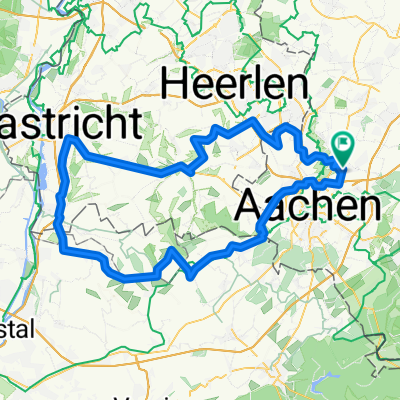 Die Würselen, Vise, Maastricht, Kerkrade, Würselen Runde
- Distance
- 99.3 km
- Ascent
- 773 m
- Descent
- 808 m
- Location
- Würselen, North Rhine-Westphalia, Germany
Open it in the app