

hoyel-melle
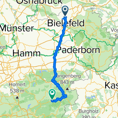
A cycling route starting in Spenge, North Rhine-Westphalia, Germany.
Overview
About this route
(cloned from route 1719797) (cloned from route 2491199) (cloned from route 3067989) (cloned from route 3067996)
- -:--
- Duration
- 32.5 km
- Distance
- 131 m
- Ascent
- 128 m
- Descent
- ---
- Avg. speed
- ---
- Max. altitude
Route quality
Waytypes & surfaces along the route
Waytypes
Quiet road
17.2 km
(53 %)
Path
6.8 km
(21 %)
Surfaces
Paved
25.3 km
(78 %)
Unpaved
0.6 km
(2 %)
Asphalt
23.1 km
(71 %)
Paved (undefined)
1.9 km
(6 %)
Continue with Bikemap
Use, edit, or download this cycling route
You would like to ride hoyel-melle or customize it for your own trip? Here is what you can do with this Bikemap route:
Free features
- Save this route as favorite or in collections
- Copy & plan your own version of this route
- Sync your route with Garmin or Wahoo
Premium features
Free trial for 3 days, or one-time payment. More about Bikemap Premium.
- Navigate this route on iOS & Android
- Export a GPX / KML file of this route
- Create your custom printout (try it for free)
- Download this route for offline navigation
Discover more Premium features.
Get Bikemap PremiumFrom our community
Other popular routes starting in Spenge
 hoyel-melle
- Distance
- 32.5 km
- Ascent
- 130 m
- Descent
- 127 m
- Location
- Spenge, North Rhine-Westphalia, Germany
 Spenge
- Distance
- 25.8 km
- Ascent
- 144 m
- Descent
- 150 m
- Location
- Spenge, North Rhine-Westphalia, Germany
 Spenge nach Bünde....
- Distance
- 12.7 km
- Ascent
- 54 m
- Descent
- 80 m
- Location
- Spenge, North Rhine-Westphalia, Germany
 Müdehorst
- Distance
- 12.7 km
- Ascent
- 104 m
- Descent
- 131 m
- Location
- Spenge, North Rhine-Westphalia, Germany
 Tannenweg nach Elsestraße
- Distance
- 18.5 km
- Ascent
- 81 m
- Descent
- 173 m
- Location
- Spenge, North Rhine-Westphalia, Germany
 Sauerland: Bielefeld-Schmallenberg - Alternativroute
- Distance
- 152.5 km
- Ascent
- 1,323 m
- Descent
- 1,069 m
- Location
- Spenge, North Rhine-Westphalia, Germany
 Aufnahme vom 8. November 11:49
- Distance
- 44.5 km
- Ascent
- 378 m
- Descent
- 378 m
- Location
- Spenge, North Rhine-Westphalia, Germany
 Enger.Teenhausen,Spenge, Enger
- Distance
- 28.2 km
- Ascent
- 157 m
- Descent
- 159 m
- Location
- Spenge, North Rhine-Westphalia, Germany
Open it in the app