


Un passo dal Cielo-Agosto 2021-Valle Aurina, Dobbiaco
- 51.4 km
- 474 m
- 224 m
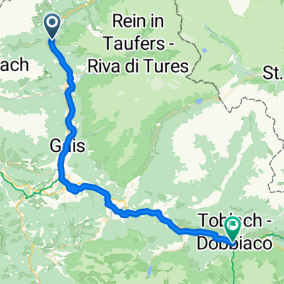
- Sand in Taufers, Trentino-Alto Adige, Italy
A cycling route starting in Sand in Taufers, Trentino-Alto Adige, Italy.
Overview
a-high-mountain-route-in-the-natural-park-rieserfern-ahr
created this 10 years ago
Route quality
Track
30.7 km
(33 %)
Quiet road
17.7 km
(19 %)
Paved
59.6 km
(64 %)
Unpaved
22.3 km
(24 %)
Asphalt
53.1 km
(57 %)
Gravel
12.1 km
(13 %)
Continue with Bikemap
You would like to ride a-high-mountain-route-in-the-natural-park-rieserfern-ahr - proposed or customize it for your own trip? Here is what you can do with this Bikemap route:
Free trial for 3 days, or one-time payment. More about Bikemap Premium.
Discover more Premium features.
Get Bikemap PremiumFrom our community
Open it in the app


