

Wiblingen-Ochsenhausen über Ringschnait
A cycling route starting in Staig, Baden-Wurttemberg, Germany.
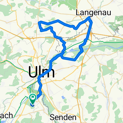
Overview
About this route
Ride through open landscapes, but also through many beautiful forests
- -:--
- Duration
- 99.8 km
- Distance
- 360 m
- Ascent
- 368 m
- Descent
- ---
- Avg. speed
- ---
- Max. altitude

Route quality
Waytypes & surfaces along the route
Waytypes
Track
30.9 km
(31 %)
Quiet road
23 km
(23 %)
Surfaces
Paved
87.8 km
(88 %)
Asphalt
84.8 km
(85 %)
Paved (undefined)
2 km
(2 %)
Continue with Bikemap
Use, edit, or download this cycling route
You would like to ride Wiblingen-Ochsenhausen über Ringschnait or customize it for your own trip? Here is what you can do with this Bikemap route:
Free features
- Save this route as favorite or in collections
- Copy & plan your own version of this route
- Split it into stages to create a multi-day tour
- Sync your route with Garmin or Wahoo
Premium features
Free trial for 3 days, or one-time payment. More about Bikemap Premium.
- Navigate this route on iOS & Android
- Export a GPX / KML file of this route
- Create your custom printout (try it for free)
- Download this route for offline navigation
Discover more Premium features.
Get Bikemap PremiumFrom our community
Other popular routes starting in Staig
 Rundtour zum Blautopf und über Ulm zurück
- Distance
- 63.8 km
- Ascent
- 471 m
- Descent
- 473 m
- Location
- Staig, Baden-Wurttemberg, Germany
 201405-02 Iller - Donau - Zusam Ulm - Hörvelsingen
- Distance
- 23.9 km
- Ascent
- 167 m
- Descent
- 146 m
- Location
- Staig, Baden-Wurttemberg, Germany
 Im Gässele 9, Ulm nach Im Gässele 7, Ulm
- Distance
- 39.8 km
- Ascent
- 182 m
- Descent
- 184 m
- Location
- Staig, Baden-Wurttemberg, Germany
 Feierabendrunde
- Distance
- 30.9 km
- Ascent
- 133 m
- Descent
- 133 m
- Location
- Staig, Baden-Wurttemberg, Germany
 Gaststätte Butzental
- Distance
- 10.3 km
- Ascent
- 152 m
- Descent
- 46 m
- Location
- Staig, Baden-Wurttemberg, Germany
 Einstein Triathlon Radstrecke
- Distance
- 62.1 km
- Ascent
- 252 m
- Descent
- 252 m
- Location
- Staig, Baden-Wurttemberg, Germany
 Wiblingen-Ochsenhausen über Ringschnait
- Distance
- 99.8 km
- Ascent
- 360 m
- Descent
- 368 m
- Location
- Staig, Baden-Wurttemberg, Germany
 Hopfensee
- Distance
- 121.4 km
- Ascent
- 941 m
- Descent
- 637 m
- Location
- Staig, Baden-Wurttemberg, Germany
Open it in the app