

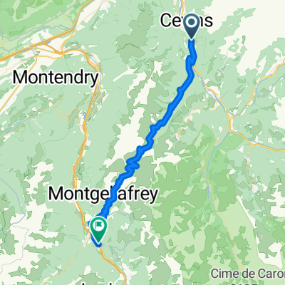
Col de la Bathie
A cycling route starting in La Bâthie, Auvergne-Rhône-Alpes, France.
Overview
About this route
1st 12 kilometres are paved then rocky road. Final few kilometres are fantastic.
- -:--
- Duration
- 40 km
- Distance
- 1,641 m
- Ascent
- 1,645 m
- Descent
- ---
- Avg. speed
- ---
- Max. altitude

Route highlights
Points of interest along the route
Point of interest after 21.2 km
Col de la Bathie
Continue with Bikemap
Use, edit, or download this cycling route
You would like to ride Col de la Bathie or customize it for your own trip? Here is what you can do with this Bikemap route:
Free features
- Save this route as favorite or in collections
- Copy & plan your own version of this route
- Sync your route with Garmin or Wahoo
Premium features
Free trial for 3 days, or one-time payment. More about Bikemap Premium.
- Navigate this route on iOS & Android
- Export a GPX / KML file of this route
- Create your custom printout (try it for free)
- Download this route for offline navigation
Discover more Premium features.
Get Bikemap PremiumFrom our community
Other popular routes starting in La Bâthie
 Tours-en-Savoie - Tignes Val Claret
- Distance
- 235.9 km
- Ascent
- 5,878 m
- Descent
- 4,158 m
- Location
- La Bâthie, Auvergne-Rhône-Alpes, France
 Francia Alpok 10
- Distance
- 110.9 km
- Ascent
- 1,558 m
- Descent
- 1,543 m
- Location
- La Bâthie, Auvergne-Rhône-Alpes, France
 Franse Alpen stage5
- Distance
- 111.2 km
- Ascent
- 2,196 m
- Descent
- 1,668 m
- Location
- La Bâthie, Auvergne-Rhône-Alpes, France
 FA06 Val d'Isere
- Distance
- 84.3 km
- Ascent
- 1,980 m
- Descent
- 487 m
- Location
- La Bâthie, Auvergne-Rhône-Alpes, France
 tdf9
tdf9- Distance
- 49.6 km
- Ascent
- 1,628 m
- Descent
- 1,569 m
- Location
- La Bâthie, Auvergne-Rhône-Alpes, France
 Le Bénétant double face
- Distance
- 47.6 km
- Ascent
- 1,774 m
- Descent
- 1,772 m
- Location
- La Bâthie, Auvergne-Rhône-Alpes, France
 Col de la Loze
- Distance
- 104.9 km
- Ascent
- 2,104 m
- Descent
- 2,104 m
- Location
- La Bâthie, Auvergne-Rhône-Alpes, France
 2014-Jour9.Col-de-la-Madeleine-Nord-Sud-Nord
- Distance
- 112.9 km
- Ascent
- 3,128 m
- Descent
- 3,126 m
- Location
- La Bâthie, Auvergne-Rhône-Alpes, France
Open it in the app