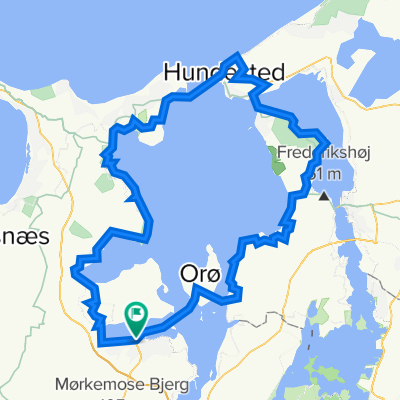
Andelslandsbyen Nyvang
A cycling route starting in Holbæk, Region Zealand, Denmark.
Overview
About this route
En fin tur på stisystem direkte til anelslandsbyen, hvor der er fri adgang mod forevisning af HFC's bomkort. Turen kn et. kmbnersed Arnolds Bjeg,hvor der er udsig over hele Holbæk.
Vær opmærksom på at distancen er 8 km. tur/retur.- -:--
- Duration
- 4.1 km
- Distance
- 30 m
- Ascent
- 12 m
- Descent
- ---
- Avg. speed
- ---
- Avg. speed
Route quality
Waytypes & surfaces along the route
Waytypes
Undefined
4.1 km
(100 %)
Surfaces
Undefined
4.1 km
(100 %)
Route highlights
Points of interest along the route
Point of interest after 3.3 km
Arnolds Bjerg
Continue with Bikemap
Use, edit, or download this cycling route
You would like to ride Andelslandsbyen Nyvang or customize it for your own trip? Here is what you can do with this Bikemap route:
Free features
- Save this route as favorite or in collections
- Copy & plan your own version of this route
- Sync your route with Garmin or Wahoo
Premium features
Free trial for 3 days, or one-time payment. More about Bikemap Premium.
- Navigate this route on iOS & Android
- Export a GPX / KML file of this route
- Create your custom printout (try it for free)
- Download this route for offline navigation
Discover more Premium features.
Get Bikemap PremiumFrom our community
Other popular routes starting in Holbæk
- Holbæk to Sjællands Odde
- Distance
- 63.5 km
- Ascent
- 255 m
- Descent
- 264 m
- Location
- Holbæk, Region Zealand, Denmark
- Munkholm - Tølløse - Holbæk
- Distance
- 38.3 km
- Ascent
- 168 m
- Descent
- 166 m
- Location
- Holbæk, Region Zealand, Denmark
- Rundtur Tusenæs
- Distance
- 22.7 km
- Ascent
- 76 m
- Descent
- 83 m
- Location
- Holbæk, Region Zealand, Denmark
- Holbæk Havn (færge) to Holbæk Havn (færge)
- Distance
- 111 km
- Ascent
- 1,016 m
- Descent
- 1,013 m
- Location
- Holbæk, Region Zealand, Denmark
- TUSE NÆS
- Distance
- 44.6 km
- Ascent
- 177 m
- Descent
- 172 m
- Location
- Holbæk, Region Zealand, Denmark
- Andelslandsbyen Nyvang
- Distance
- 4.1 km
- Ascent
- 30 m
- Descent
- 12 m
- Location
- Holbæk, Region Zealand, Denmark
- From Holbæk via Munkholm to Tåstrup
- Distance
- 56.2 km
- Ascent
- 290 m
- Descent
- 265 m
- Location
- Holbæk, Region Zealand, Denmark
- CN 7.6.2020 88 KM
- Distance
- 88.5 km
- Ascent
- 239 m
- Descent
- 239 m
- Location
- Holbæk, Region Zealand, Denmark