

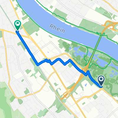
Hochkreuz bis Königswinter
A cycling route starting in Königswinter, North Rhine-Westphalia, Germany.
Overview
About this route
None (cloned from route 1542018)
- -:--
- Duration
- 27.2 km
- Distance
- 101 m
- Ascent
- 104 m
- Descent
- ---
- Avg. speed
- ---
- Max. altitude
Route quality
Waytypes & surfaces along the route
Waytypes
Quiet road
6.2 km
(23 %)
Access road
4.5 km
(16 %)
Surfaces
Paved
26.1 km
(96 %)
Unpaved
0.5 km
(2 %)
Asphalt
23.6 km
(87 %)
Paving stones
1.5 km
(6 %)
Continue with Bikemap
Use, edit, or download this cycling route
You would like to ride Hochkreuz bis Königswinter or customize it for your own trip? Here is what you can do with this Bikemap route:
Free features
- Save this route as favorite or in collections
- Copy & plan your own version of this route
- Sync your route with Garmin or Wahoo
Premium features
Free trial for 3 days, or one-time payment. More about Bikemap Premium.
- Navigate this route on iOS & Android
- Export a GPX / KML file of this route
- Create your custom printout (try it for free)
- Download this route for offline navigation
Discover more Premium features.
Get Bikemap PremiumFrom our community
Other popular routes starting in Königswinter
 mahagonis Abschlußrunde 30.9.07 ca.60 km!
- Distance
- 50.4 km
- Ascent
- 299 m
- Descent
- 300 m
- Location
- Königswinter, North Rhine-Westphalia, Germany
 Singletrailtour Siebengebirge
- Distance
- 33.4 km
- Ascent
- 1,070 m
- Descent
- 1,070 m
- Location
- Königswinter, North Rhine-Westphalia, Germany
 BONN-tria 2008 mit Wechselzone
- Distance
- 58.8 km
- Ascent
- 691 m
- Descent
- 696 m
- Location
- Königswinter, North Rhine-Westphalia, Germany
 Ahrweiler Tour
- Distance
- 41.8 km
- Ascent
- 514 m
- Descent
- 513 m
- Location
- Königswinter, North Rhine-Westphalia, Germany
 Siebengebirge Süd
- Distance
- 44 km
- Ascent
- 546 m
- Descent
- 539 m
- Location
- Königswinter, North Rhine-Westphalia, Germany
 Innere Wachtbergroute
- Distance
- 21.1 km
- Ascent
- 222 m
- Descent
- 205 m
- Location
- Königswinter, North Rhine-Westphalia, Germany
 Bad Godesberg-Altenahr
- Distance
- 71.6 km
- Ascent
- 579 m
- Descent
- 589 m
- Location
- Königswinter, North Rhine-Westphalia, Germany
 Route nach Bonn
- Distance
- 3.9 km
- Ascent
- 16 m
- Descent
- 10 m
- Location
- Königswinter, North Rhine-Westphalia, Germany
Open it in the app