

CNaB - Etape 5 - Josselin --- Rochefort en Terre
A cycling route starting in Guégon, Brittany Region, France.
Overview
About this route
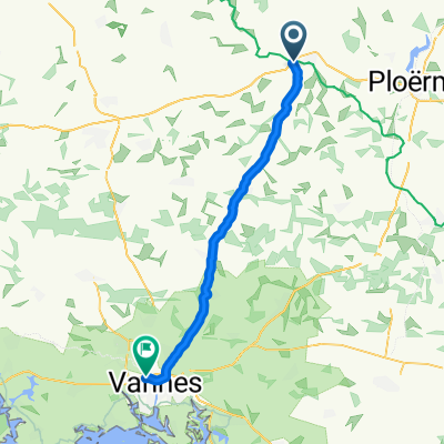
Départ: Camping Josselin
Arrivée: Chemin du Bogeais- -:--
- Duration
- 45.4 km
- Distance
- 210 m
- Ascent
- 181 m
- Descent
- ---
- Avg. speed
- ---
- Max. altitude
Route quality
Waytypes & surfaces along the route
Waytypes
Cycleway
33.5 km
(74 %)
Quiet road
4 km
(9 %)
Surfaces
Paved
36.3 km
(80 %)
Unpaved
0 km
(<1 %)
Asphalt
35.7 km
(79 %)
Paved (undefined)
0.4 km
(<1 %)
Continue with Bikemap
Use, edit, or download this cycling route
You would like to ride CNaB - Etape 5 - Josselin --- Rochefort en Terre or customize it for your own trip? Here is what you can do with this Bikemap route:
Free features
- Save this route as favorite or in collections
- Copy & plan your own version of this route
- Sync your route with Garmin or Wahoo
Premium features
Free trial for 3 days, or one-time payment. More about Bikemap Premium.
- Navigate this route on iOS & Android
- Export a GPX / KML file of this route
- Create your custom printout (try it for free)
- Download this route for offline navigation
Discover more Premium features.
Get Bikemap PremiumFrom our community
Other popular routes starting in Guégon
 Etappe 24: Saint Geran - Redon
- Distance
- 69.7 km
- Ascent
- 226 m
- Descent
- 261 m
- Location
- Guégon, Brittany Region, France
 De Le Bas de la Lande, Guégon à Rue Madame de Ségur 14, Vannes
- Distance
- 41.9 km
- Ascent
- 67 m
- Descent
- 282 m
- Location
- Guégon, Brittany Region, France
 EuroVelo 1 - Part 64
- Distance
- 102.1 km
- Ascent
- 251 m
- Descent
- 266 m
- Location
- Guégon, Brittany Region, France
 07-Josselin/Mur-de-Bretagne
- Distance
- 56.3 km
- Ascent
- 356 m
- Descent
- 252 m
- Location
- Guégon, Brittany Region, France
 CNaB - Etape 5 - Josselin --- Rochefort en Terre
- Distance
- 45.4 km
- Ascent
- 210 m
- Descent
- 181 m
- Location
- Guégon, Brittany Region, France
 EuroVelo 1 – La Vélodyssée: Guégon to Pontivy
- Distance
- 44.5 km
- Ascent
- 242 m
- Descent
- 215 m
- Location
- Guégon, Brittany Region, France
 Josselin Vannes
- Distance
- 39.4 km
- Ascent
- 369 m
- Descent
- 372 m
- Location
- Guégon, Brittany Region, France
 De Le Bas de la Lande, Guégon à Place du Bouffay 6, Malestroit
- Distance
- 26.5 km
- Ascent
- 257 m
- Descent
- 288 m
- Location
- Guégon, Brittany Region, France
Open it in the app