

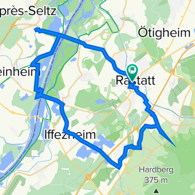
Rastatt - Bad Herrenalb
A cycling route starting in Rastatt, Baden-Wurttemberg, Germany.
Overview
About this route
The highest point is just like Ślęża, i.e., 718 m above sea level.
- -:--
- Duration
- 90.8 km
- Distance
- 1,235 m
- Ascent
- 1,232 m
- Descent
- ---
- Avg. speed
- ---
- Max. altitude

Route quality
Waytypes & surfaces along the route
Waytypes
Road
23.6 km
(26 %)
Quiet road
12.7 km
(14 %)
Surfaces
Paved
86.3 km
(95 %)
Unpaved
2.7 km
(3 %)
Asphalt
86.3 km
(95 %)
Unpaved (undefined)
0.9 km
(1 %)
Continue with Bikemap
Use, edit, or download this cycling route
You would like to ride Rastatt - Bad Herrenalb or customize it for your own trip? Here is what you can do with this Bikemap route:
Free features
- Save this route as favorite or in collections
- Copy & plan your own version of this route
- Split it into stages to create a multi-day tour
- Sync your route with Garmin or Wahoo
Premium features
Free trial for 3 days, or one-time payment. More about Bikemap Premium.
- Navigate this route on iOS & Android
- Export a GPX / KML file of this route
- Create your custom printout (try it for free)
- Download this route for offline navigation
Discover more Premium features.
Get Bikemap PremiumFrom our community
Other popular routes starting in Rastatt
 Raststatt kurz
- Distance
- 39 km
- Ascent
- 117 m
- Descent
- 117 m
- Location
- Rastatt, Baden-Wurttemberg, Germany
 Rundtour Rastatt
- Distance
- 26.6 km
- Ascent
- 5 m
- Descent
- 8 m
- Location
- Rastatt, Baden-Wurttemberg, Germany
 Weserstraße, Rastatt nach Händelstraße, Ötigheim
- Distance
- 7.9 km
- Ascent
- 18 m
- Descent
- 22 m
- Location
- Rastatt, Baden-Wurttemberg, Germany
 Leonberg
- Distance
- 216.2 km
- Ascent
- 2,359 m
- Descent
- 2,359 m
- Location
- Rastatt, Baden-Wurttemberg, Germany
 Rastatt - Bad Herrenalb
- Distance
- 90.8 km
- Ascent
- 1,235 m
- Descent
- 1,232 m
- Location
- Rastatt, Baden-Wurttemberg, Germany
 badenhotel
- Distance
- 28.3 km
- Ascent
- 511 m
- Descent
- 420 m
- Location
- Rastatt, Baden-Wurttemberg, Germany
 Rastatt - Straßburg
- Distance
- 64.3 km
- Ascent
- 155 m
- Descent
- 125 m
- Location
- Rastatt, Baden-Wurttemberg, Germany
 badenhotel2
- Distance
- 25.2 km
- Ascent
- 256 m
- Descent
- 158 m
- Location
- Rastatt, Baden-Wurttemberg, Germany
Open it in the app