

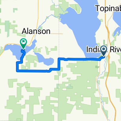
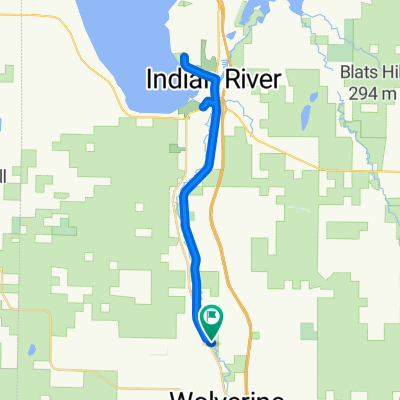
2009 DALMAC 4 day east, Day 4, Topinabee to Pellston Michigan
A cycling route starting in Indian River, Michigan, United States.
Overview
About this route
2009 DALMAC 4 day east
section from Topinabee to Pellston
Some Big Hill
- -:--
- Duration
- 21.7 km
- Distance
- 182 m
- Ascent
- 157 m
- Descent
- ---
- Avg. speed
- ---
- Max. altitude
Continue with Bikemap
Use, edit, or download this cycling route
You would like to ride 2009 DALMAC 4 day east, Day 4, Topinabee to Pellston Michigan or customize it for your own trip? Here is what you can do with this Bikemap route:
Free features
- Save this route as favorite or in collections
- Copy & plan your own version of this route
- Sync your route with Garmin or Wahoo
Premium features
Free trial for 3 days, or one-time payment. More about Bikemap Premium.
- Navigate this route on iOS & Android
- Export a GPX / KML file of this route
- Create your custom printout (try it for free)
- Download this route for offline navigation
Discover more Premium features.
Get Bikemap PremiumFrom our community
Other popular routes starting in Indian River
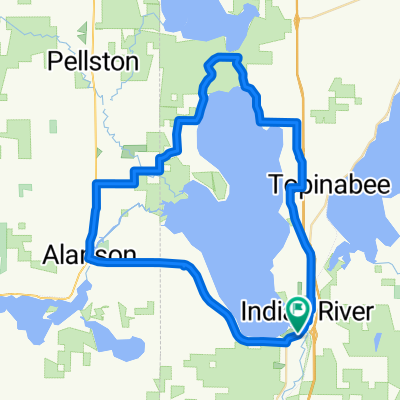 Around Burt Lake
- Distance
- 58.4 km
- Ascent
- 205 m
- Descent
- 200 m
- Location
- Indian River, Michigan, United States
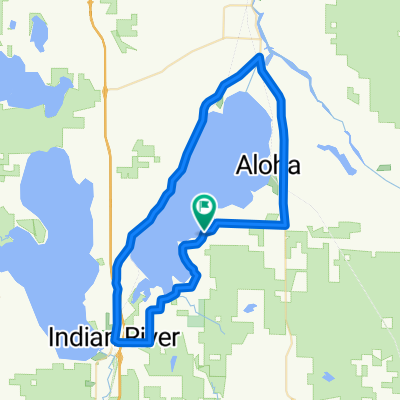 Around Mullet Lake
- Distance
- 59 km
- Ascent
- 243 m
- Descent
- 243 m
- Location
- Indian River, Michigan, United States
 Short bike tour through Ayr
- Distance
- 0.2 km
- Ascent
- 0 m
- Descent
- 0 m
- Location
- Indian River, Michigan, United States
 Riggsville Rd, Pellston to 209 State St, Charlevoix
- Distance
- 66.3 km
- Ascent
- 273 m
- Descent
- 318 m
- Location
- Indian River, Michigan, United States
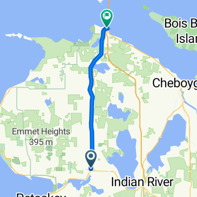 Indian River - Saint Ignace
- Distance
- 39.5 km
- Ascent
- 72 m
- Descent
- 82 m
- Location
- Indian River, Michigan, United States
 Burt lake to Oden Island nature preserve
- Distance
- 24.9 km
- Ascent
- 125 m
- Descent
- 121 m
- Location
- Indian River, Michigan, United States
 Haakwood to Nature Preserve
- Distance
- 32.6 km
- Ascent
- 130 m
- Descent
- 129 m
- Location
- Indian River, Michigan, United States
 Burt lake to Cheboygan state park
- Distance
- 42 km
- Ascent
- 137 m
- Descent
- 145 m
- Location
- Indian River, Michigan, United States
Open it in the app