

Radtour - Himmelfahrt 2015
A cycling route starting in Erfurt, Thuringia, Germany.
Overview
About this route
Ascension Day Tour 2015
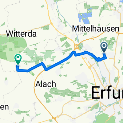
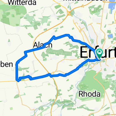
Erfurt - Airport - Friemar
Seebergen - Ingersleben - Erfurt
- -:--
- Duration
- 62.3 km
- Distance
- 240 m
- Ascent
- 239 m
- Descent
- ---
- Avg. speed
- ---
- Max. altitude

Continue with Bikemap
Use, edit, or download this cycling route
You would like to ride Radtour - Himmelfahrt 2015 or customize it for your own trip? Here is what you can do with this Bikemap route:
Free features
- Save this route as favorite or in collections
- Copy & plan your own version of this route
- Sync your route with Garmin or Wahoo
Premium features
Free trial for 3 days, or one-time payment. More about Bikemap Premium.
- Navigate this route on iOS & Android
- Export a GPX / KML file of this route
- Create your custom printout (try it for free)
- Download this route for offline navigation
Discover more Premium features.
Get Bikemap PremiumFrom our community
Other popular routes starting in Erfurt
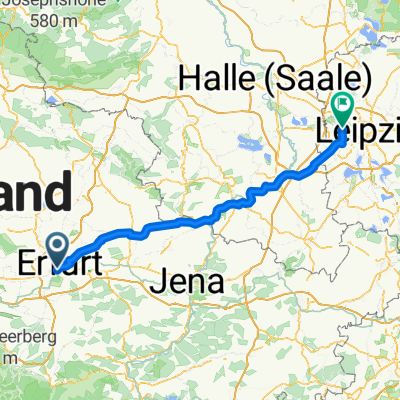 Erfurt nach Leipzig Variante Etappe 3
- Distance
- 116.4 km
- Ascent
- 489 m
- Descent
- 580 m
- Location
- Erfurt, Thuringia, Germany
 L1055 nach L1055
- Distance
- 14.2 km
- Ascent
- 92 m
- Descent
- 144 m
- Location
- Erfurt, Thuringia, Germany
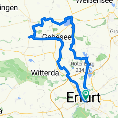
 Erfurt-Mölsdorf
- Distance
- 32.7 km
- Ascent
- 191 m
- Descent
- 237 m
- Location
- Erfurt, Thuringia, Germany
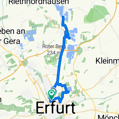
 Stotternheim
- Distance
- 33.7 km
- Ascent
- 145 m
- Descent
- 144 m
- Location
- Erfurt, Thuringia, Germany
 Rund um die Erfurter Seen mit Restaurant Alberstädter See
- Distance
- 77.5 km
- Ascent
- 209 m
- Descent
- 211 m
- Location
- Erfurt, Thuringia, Germany
 See Route
- Distance
- 25.7 km
- Ascent
- 40 m
- Descent
- 43 m
- Location
- Erfurt, Thuringia, Germany
 Julius-Leber-Ring nach Rodeweg
- Distance
- 13.1 km
- Ascent
- 181 m
- Descent
- 48 m
- Location
- Erfurt, Thuringia, Germany
 ermstedt
- Distance
- 29.6 km
- Ascent
- 154 m
- Descent
- 155 m
- Location
- Erfurt, Thuringia, Germany
Open it in the app