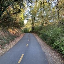
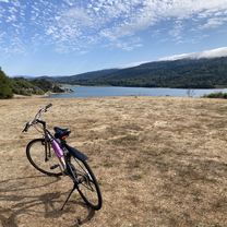
Sawyer Camp Trail to Polhemus Rd
A cycling route starting in Highlands-Baywood Park, California, United States of America.
Overview
About this route
18 mile bike ride in San Mateo area
- -:--
- Duration
- 28.9 km
- Distance
- 304 m
- Ascent
- 316 m
- Descent
- ---
- Avg. speed
- ---
- Avg. speed
Route quality
Waytypes & surfaces along the route
Waytypes
Cycleway
18.1 km
(62 %)
Busy road
8.3 km
(29 %)
Surfaces
Paved
26.2 km
(91 %)
Asphalt
26.2 km
(91 %)
Undefined
2.7 km
(9 %)
Continue with Bikemap
Use, edit, or download this cycling route
You would like to ride Sawyer Camp Trail to Polhemus Rd or customize it for your own trip? Here is what you can do with this Bikemap route:
Free features
- Save this route as favorite or in collections
- Copy & plan your own version of this route
- Sync your route with Garmin or Wahoo
Premium features
Free trial for 3 days, or one-time payment. More about Bikemap Premium.
- Navigate this route on iOS & Android
- Export a GPX / KML file of this route
- Create your custom printout (try it for free)
- Download this route for offline navigation
Discover more Premium features.
Get Bikemap PremiumFrom our community
Other popular routes starting in Highlands-Baywood Park
- 36–40 Canada Rd, Redwood City to 2 Mount Vernon Ln, Atherton
- Distance
- 19.4 km
- Ascent
- 139 m
- Descent
- 222 m
- Location
- Highlands-Baywood Park, California, United States of America
- Canada to woodside
- Distance
- 23.4 km
- Ascent
- 193 m
- Descent
- 189 m
- Location
- Highlands-Baywood Park, California, United States of America
- 3.a Bay Area Ridge Trail SF watershed Bypass
- Distance
- 21 km
- Ascent
- 315 m
- Descent
- 361 m
- Location
- Highlands-Baywood Park, California, United States of America
- Can#ada up La Honda
- Distance
- 45 km
- Ascent
- 628 m
- Descent
- 639 m
- Location
- Highlands-Baywood Park, California, United States of America
- Skyline - Tunigas
- Distance
- 74.7 km
- Ascent
- 1,279 m
- Descent
- 1,275 m
- Location
- Highlands-Baywood Park, California, United States of America
- Canada-Alpine-Page Mill loop
- Distance
- 93.1 km
- Ascent
- 2,193 m
- Descent
- 2,169 m
- Location
- Highlands-Baywood Park, California, United States of America
- Belmont Woods Way, Belmont to Belmont Woods Way, Belmont
- Distance
- 19 km
- Ascent
- 515 m
- Descent
- 514 m
- Location
- Highlands-Baywood Park, California, United States of America
- Canada Sprint
- Distance
- 9 km
- Ascent
- 134 m
- Descent
- 78 m
- Location
- Highlands-Baywood Park, California, United States of America
Open it in the app