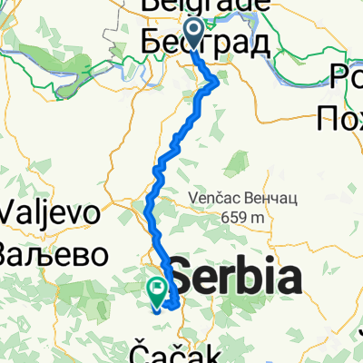
uzivanje,
A cycling route starting in Rakovica, Central Serbia, Serbia.
Overview
About this route
dumres after the forest, after bleja
- -:--
- Duration
- 40.7 km
- Distance
- 203 m
- Ascent
- 203 m
- Descent
- ---
- Avg. speed
- ---
- Max. altitude
Route quality
Waytypes & surfaces along the route
Waytypes
Road
31.8 km
(78 %)
Quiet road
2.4 km
(6 %)
Surfaces
Paved
34.2 km
(84 %)
Asphalt
34.2 km
(84 %)
Undefined
6.5 km
(16 %)
Continue with Bikemap
Use, edit, or download this cycling route
You would like to ride uzivanje, or customize it for your own trip? Here is what you can do with this Bikemap route:
Free features
- Save this route as favorite or in collections
- Copy & plan your own version of this route
- Sync your route with Garmin or Wahoo
Premium features
Free trial for 3 days, or one-time payment. More about Bikemap Premium.
- Navigate this route on iOS & Android
- Export a GPX / KML file of this route
- Create your custom printout (try it for free)
- Download this route for offline navigation
Discover more Premium features.
Get Bikemap PremiumFrom our community
Other popular routes starting in Rakovica
- Cerak - Banjica
- Distance
- 17 km
- Ascent
- 371 m
- Descent
- 373 m
- Location
- Rakovica, Central Serbia, Serbia
- Миљаковачке ливаде 15c, Београд to Обилићев венац 29, Београд
- Distance
- 13.8 km
- Ascent
- 214 m
- Descent
- 241 m
- Location
- Rakovica, Central Serbia, Serbia
- Zeleznik-Ada
- Distance
- 23.7 km
- Ascent
- 39 m
- Descent
- 36 m
- Location
- Rakovica, Central Serbia, Serbia
- Cerak - Avala
- Distance
- 23.6 km
- Ascent
- 554 m
- Descent
- 223 m
- Location
- Rakovica, Central Serbia, Serbia
- Voznjica do posla
- Distance
- 74.3 km
- Ascent
- 338 m
- Descent
- 399 m
- Location
- Rakovica, Central Serbia, Serbia
- Krug Zeleznik Ada veci
- Distance
- 37.1 km
- Ascent
- 316 m
- Descent
- 313 m
- Location
- Rakovica, Central Serbia, Serbia
- uzivanje,
- Distance
- 40.7 km
- Ascent
- 203 m
- Descent
- 203 m
- Location
- Rakovica, Central Serbia, Serbia
- Avala - Vračar
- Distance
- 19.5 km
- Ascent
- 158 m
- Descent
- 488 m
- Location
- Rakovica, Central Serbia, Serbia
Open it in the app