

Hoffnungsthal Radwanderung
A cycling route starting in Altstadt Nord, North Rhine-Westphalia, Germany.
Overview
About this route
'Hoffnungsthal' derives from a hammer mill named 'Hoffnungsthaler Hammer'. The mill provided bread and work to the poor rural population. During this period of economic upswing, in 1890, it was connected to the railway network. With the Sülztal railway, the products of the iron forge reached Cologne-Mülheim on the Rhine and the wider world.
- -:--
- Duration
- 61.9 km
- Distance
- 236 m
- Ascent
- 229 m
- Descent
- ---
- Avg. speed
- ---
- Max. altitude

Route quality
Waytypes & surfaces along the route
Waytypes
Quiet road
20.4 km
(33 %)
Track
18.6 km
(30 %)
Surfaces
Paved
39 km
(63 %)
Unpaved
15.5 km
(25 %)
Asphalt
35.3 km
(57 %)
Gravel
11.1 km
(18 %)
Route highlights
Points of interest along the route

Accommodation after 27.8 km
Marlene's Cafe&Restaurant am Schlosss Zum Eulenbroicher Auel 19 51503 Rösrath 02205 920 7876 Unsere Öffnungszeiten Di: Sa. :11:00 - 22:00
Continue with Bikemap
Use, edit, or download this cycling route
You would like to ride Hoffnungsthal Radwanderung or customize it for your own trip? Here is what you can do with this Bikemap route:
Free features
- Save this route as favorite or in collections
- Copy & plan your own version of this route
- Sync your route with Garmin or Wahoo
Premium features
Free trial for 3 days, or one-time payment. More about Bikemap Premium.
- Navigate this route on iOS & Android
- Export a GPX / KML file of this route
- Create your custom printout (try it for free)
- Download this route for offline navigation
Discover more Premium features.
Get Bikemap PremiumFrom our community
Other popular routes starting in Altstadt Nord
 Königsforst Porz
- Distance
- 34.9 km
- Ascent
- 121 m
- Descent
- 106 m
- Location
- Altstadt Nord, North Rhine-Westphalia, Germany
 Kloster Knechtsteden_ Radtour
- Distance
- 60.5 km
- Ascent
- 73 m
- Descent
- 76 m
- Location
- Altstadt Nord, North Rhine-Westphalia, Germany
 Königsforst Wahner-Heide
- Distance
- 61.2 km
- Ascent
- 220 m
- Descent
- 201 m
- Location
- Altstadt Nord, North Rhine-Westphalia, Germany
 Königsforst_Porz
- Distance
- 35 km
- Ascent
- 117 m
- Descent
- 111 m
- Location
- Altstadt Nord, North Rhine-Westphalia, Germany
 Vatertagstour Köln - Neuss
- Distance
- 46.1 km
- Ascent
- 64 m
- Descent
- 82 m
- Location
- Altstadt Nord, North Rhine-Westphalia, Germany
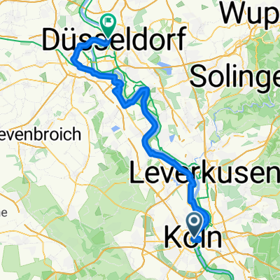 Trankgassenwerft 3050, Köln to Rheinwiesen 1, Düsseldorf
- Distance
- 72.3 km
- Ascent
- 167 m
- Descent
- 172 m
- Location
- Altstadt Nord, North Rhine-Westphalia, Germany
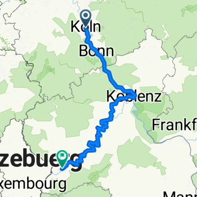 Von Köln bis Trier
- Distance
- 289.3 km
- Ascent
- 2,791 m
- Descent
- 2,707 m
- Location
- Altstadt Nord, North Rhine-Westphalia, Germany
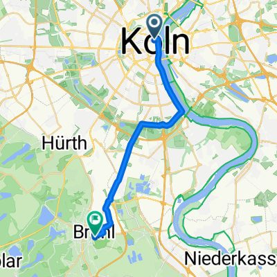 5_Köln - Brühl
- Distance
- 17.8 km
- Ascent
- 63 m
- Descent
- 56 m
- Location
- Altstadt Nord, North Rhine-Westphalia, Germany
Open it in the app