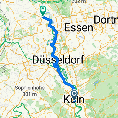
Krewelshof Wahner-Heide Radtour
A cycling route starting in Altstadt Sud, North Rhine-Westphalia, Germany.
Overview
About this route
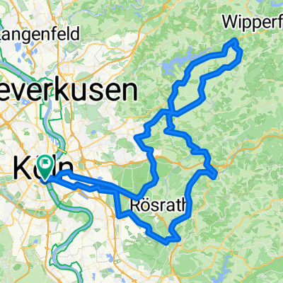
Viel zu entdecken und erleben gibt es im Erlebnisbauernhof Krewelshof in Lohmar für die ganze Familie. Die Wahner Heide ist überwiegend eine Bundesliegenschaft, vor Ort betreut durch das Bundesforstamt Wahnerheide. Es ist für Jagd und Forstwirtschaft zuständig und setzt Maßnahmen für die Flughafen um. Die Wahner Heide ist aufgeteilt auf drei Gebietskörperschaften: Stadt Köln, Rheinisch-Bergischer Kreis und Rhein-Sieg-Kreis.
- -:--
- Duration
- 64.1 km
- Distance
- 122 m
- Ascent
- 126 m
- Descent
- ---
- Avg. speed
- ---
- Avg. speed
Route quality
Waytypes & surfaces along the route
Waytypes
Path
29.5 km
(46 %)
Track
16.4 km
(26 %)
Surfaces
Paved
45.9 km
(72 %)
Unpaved
13.5 km
(21 %)
Asphalt
38.6 km
(60 %)
Gravel
8.5 km
(13 %)
Continue with Bikemap
Use, edit, or download this cycling route
You would like to ride Krewelshof Wahner-Heide Radtour or customize it for your own trip? Here is what you can do with this Bikemap route:
Free features
- Save this route as favorite or in collections
- Copy & plan your own version of this route
- Sync your route with Garmin or Wahoo
Premium features
Free trial for 3 days, or one-time payment. More about Bikemap Premium.
- Navigate this route on iOS & Android
- Export a GPX / KML file of this route
- Create your custom printout (try it for free)
- Download this route for offline navigation
Discover more Premium features.
Get Bikemap PremiumFrom our community
Other popular routes starting in Altstadt Sud
- KEV Wanderheim Bugelaul
- Distance
- 51.4 km
- Ascent
- 73 m
- Descent
- 41 m
- Location
- Altstadt Sud, North Rhine-Westphalia, Germany
- Ville-Express (Liblar)
- Distance
- 55.2 km
- Ascent
- 189 m
- Descent
- 193 m
- Location
- Altstadt Sud, North Rhine-Westphalia, Germany
- Kaiserbahnhof Kierberg
- Distance
- 38.5 km
- Ascent
- 116 m
- Descent
- 110 m
- Location
- Altstadt Sud, North Rhine-Westphalia, Germany
- Schloss Morsbroich (Alkenrath)
- Distance
- 57.7 km
- Ascent
- 124 m
- Descent
- 130 m
- Location
- Altstadt Sud, North Rhine-Westphalia, Germany
- Eschmarer Mühle-Siegfähre
- Distance
- 60.6 km
- Ascent
- 60 m
- Descent
- 69 m
- Location
- Altstadt Sud, North Rhine-Westphalia, Germany
- RuK 2010
- Distance
- 69.1 km
- Ascent
- 366 m
- Descent
- 366 m
- Location
- Altstadt Sud, North Rhine-Westphalia, Germany
- Rund um Köln 2010
- Distance
- 67.2 km
- Ascent
- 488 m
- Descent
- 482 m
- Location
- Altstadt Sud, North Rhine-Westphalia, Germany
- Einmal ummen Airport
- Distance
- 50.4 km
- Ascent
- 130 m
- Descent
- 131 m
- Location
- Altstadt Sud, North Rhine-Westphalia, Germany
Open it in the app