

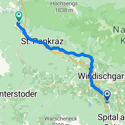
Hinterstoder-Spital Am Pyhrn-Windischgarsten
A cycling route starting in Rossleithen, Upper Austria, Austria.
Overview
About this route
malebný sjezdík
- -:--
- Duration
- 33.9 km
- Distance
- 280 m
- Ascent
- 1,016 m
- Descent
- ---
- Avg. speed
- ---
- Max. altitude

Route quality
Waytypes & surfaces along the route
Waytypes
Quiet road
12.1 km
(36 %)
Track
10.6 km
(31 %)
Surfaces
Paved
16.5 km
(49 %)
Unpaved
11.6 km
(34 %)
Asphalt
16.5 km
(49 %)
Gravel
11.5 km
(34 %)
Continue with Bikemap
Use, edit, or download this cycling route
You would like to ride Hinterstoder-Spital Am Pyhrn-Windischgarsten or customize it for your own trip? Here is what you can do with this Bikemap route:
Free features
- Save this route as favorite or in collections
- Copy & plan your own version of this route
- Sync your route with Garmin or Wahoo
Premium features
Free trial for 3 days, or one-time payment. More about Bikemap Premium.
- Navigate this route on iOS & Android
- Export a GPX / KML file of this route
- Create your custom printout (try it for free)
- Download this route for offline navigation
Discover more Premium features.
Get Bikemap PremiumFrom our community
Other popular routes starting in Rossleithen
 2025_05_02_ Hengstpass-Buchauersattel-Pyhrnpass
- Distance
- 106 km
- Ascent
- 3,012 m
- Descent
- 3,011 m
- Location
- Rossleithen, Upper Austria, Austria
 2025_05-13_Kniewas-Höss
- Distance
- 29.3 km
- Ascent
- 1,431 m
- Descent
- 1,289 m
- Location
- Rossleithen, Upper Austria, Austria
 Hinterstoder- Vorderstoder
- Distance
- 30 km
- Ascent
- 988 m
- Descent
- 988 m
- Location
- Rossleithen, Upper Austria, Austria
 Von Spital am Pyhrn bis Wels
- Distance
- 22.2 km
- Ascent
- 645 m
- Descent
- 765 m
- Location
- Rossleithen, Upper Austria, Austria
 2025_05_09_Spital am Pyhrn-Liezen-retur
- Distance
- 34.5 km
- Ascent
- 863 m
- Descent
- 863 m
- Location
- Rossleithen, Upper Austria, Austria
 Imitzberg
- Distance
- 35.6 km
- Ascent
- 841 m
- Descent
- 841 m
- Location
- Rossleithen, Upper Austria, Austria
 Windischgarsten első napi túra (R9, MTB4)
- Distance
- 103.6 km
- Ascent
- 832 m
- Descent
- 1,008 m
- Location
- Rossleithen, Upper Austria, Austria
 Hinterstoder - Hütterer Höss
- Distance
- 23.1 km
- Ascent
- 267 m
- Descent
- 1,086 m
- Location
- Rossleithen, Upper Austria, Austria
Open it in the app