

Jura 8 Col Loop
A cycling route starting in Nantua, Auvergne-Rhône-Alpes, France.
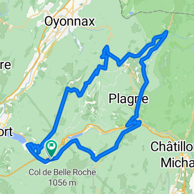
Overview
About this route
- -:--
- Duration
- 83.9 km
- Distance
- 1,562 m
- Ascent
- 1,561 m
- Descent
- ---
- Avg. speed
- ---
- Max. altitude

Route highlights
Points of interest along the route
Point of interest after 7.1 km
Col de Colliard
Point of interest after 8.9 km
Col de Belleroche
Point of interest after 15.8 km
Col de la Cheminée
Point of interest after 36.8 km
Col de la Clye
Point of interest after 37.1 km
Col de Mazière
Point of interest after 41.7 km
Col de la Rochette
Point of interest after 46.5 km
Col de la Croix de l'Orme
Point of interest after 59.8 km
Col du Cruchon
Point of interest after 63.2 km
Col de Pisseloup
Continue with Bikemap
Use, edit, or download this cycling route
You would like to ride Jura 8 Col Loop or customize it for your own trip? Here is what you can do with this Bikemap route:
Free features
- Save this route as favorite or in collections
- Copy & plan your own version of this route
- Split it into stages to create a multi-day tour
- Sync your route with Garmin or Wahoo
Premium features
Free trial for 3 days, or one-time payment. More about Bikemap Premium.
- Navigate this route on iOS & Android
- Export a GPX / KML file of this route
- Create your custom printout (try it for free)
- Download this route for offline navigation
Discover more Premium features.
Get Bikemap PremiumFrom our community
Other popular routes starting in Nantua
 Golet Hunting in the Juras
- Distance
- 47.6 km
- Ascent
- 922 m
- Descent
- 922 m
- Location
- Nantua, Auvergne-Rhône-Alpes, France
 Jura 8 Col Loop
- Distance
- 83.9 km
- Ascent
- 1,562 m
- Descent
- 1,561 m
- Location
- Nantua, Auvergne-Rhône-Alpes, France
 09_F/Neyrolles - Châtillon-sur-Chalaronne
- Distance
- 72.4 km
- Ascent
- 385 m
- Descent
- 761 m
- Location
- Nantua, Auvergne-Rhône-Alpes, France
 De 311 Rue de la Gélinotte, Nantua à 297 Rue de la Gélinotte, Nantua
- Distance
- 15.3 km
- Ascent
- 57 m
- Descent
- 52 m
- Location
- Nantua, Auvergne-Rhône-Alpes, France
 Lac Genin Loop
- Distance
- 57.2 km
- Ascent
- 1,246 m
- Descent
- 1,208 m
- Location
- Nantua, Auvergne-Rhône-Alpes, France
 circ 24 AIN
- Distance
- 85.8 km
- Ascent
- 1,377 m
- Descent
- 1,375 m
- Location
- Nantua, Auvergne-Rhône-Alpes, France
 Nantua - Monts de l'Ain
- Distance
- 89.8 km
- Ascent
- 1,567 m
- Descent
- 1,568 m
- Location
- Nantua, Auvergne-Rhône-Alpes, France
 Jura Col Hunting via Trails
- Distance
- 63 km
- Ascent
- 1,280 m
- Descent
- 1,280 m
- Location
- Nantua, Auvergne-Rhône-Alpes, France
Open it in the app