

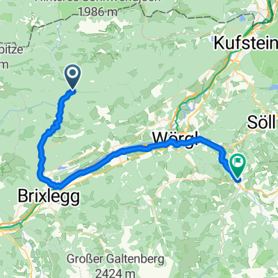
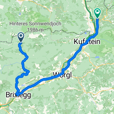
Tegernsee Hüttentour - Tag3
A cycling route starting in Brandenberg, Tyrol, Austria.
Overview
About this route
Hut tour Tegernsee day 3; possibly from Kreuth again via the Sölltal
- -:--
- Duration
- 27.9 km
- Distance
- 348 m
- Ascent
- 372 m
- Descent
- ---
- Avg. speed
- ---
- Max. altitude
Continue with Bikemap
Use, edit, or download this cycling route
You would like to ride Tegernsee Hüttentour - Tag3 or customize it for your own trip? Here is what you can do with this Bikemap route:
Free features
- Save this route as favorite or in collections
- Copy & plan your own version of this route
- Sync your route with Garmin or Wahoo
Premium features
Free trial for 3 days, or one-time payment. More about Bikemap Premium.
- Navigate this route on iOS & Android
- Export a GPX / KML file of this route
- Create your custom printout (try it for free)
- Download this route for offline navigation
Discover more Premium features.
Get Bikemap PremiumFrom our community
Other popular routes starting in Brandenberg
 Brandenberg - Hopfgarten (Brixental)
- Distance
- 42.6 km
- Ascent
- 873 m
- Descent
- 1,000 m
- Location
- Brandenberg, Tyrol, Austria
 Steinberg2
- Distance
- 27.5 km
- Ascent
- 741 m
- Descent
- 741 m
- Location
- Brandenberg, Tyrol, Austria
 Steinberg
- Distance
- 26.2 km
- Ascent
- 942 m
- Descent
- 942 m
- Location
- Brandenberg, Tyrol, Austria
 Tegernsee Hüttentour - Tag3
- Distance
- 27.9 km
- Ascent
- 348 m
- Descent
- 372 m
- Location
- Brandenberg, Tyrol, Austria
 1983_OBTI_T3_Erzherzog-Johann-Klause_Niederndorf
- Distance
- 67.7 km
- Ascent
- 353 m
- Descent
- 672 m
- Location
- Brandenberg, Tyrol, Austria
 Kaiserhaus-Brandenberg-Nachberg Hochleger-Kaiserhaus
- Distance
- 34.3 km
- Ascent
- 961 m
- Descent
- 957 m
- Location
- Brandenberg, Tyrol, Austria
 Erzherzog-Johann-Klause_Röhrlmoosalm
- Distance
- 24.8 km
- Ascent
- 672 m
- Descent
- 368 m
- Location
- Brandenberg, Tyrol, Austria
 Steinberg
- Distance
- 26.1 km
- Ascent
- 921 m
- Descent
- 921 m
- Location
- Brandenberg, Tyrol, Austria
Open it in the app