

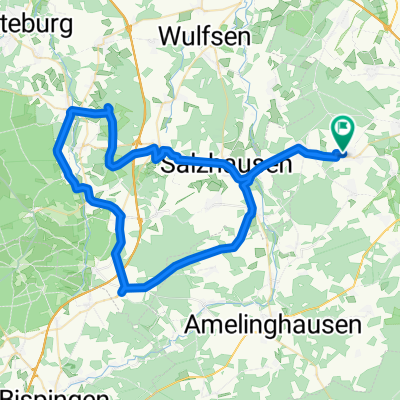
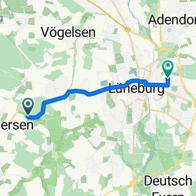
Landwehr-Singletrail_Lüneburg
A cycling route starting in Kirchgellersen, Lower Saxony, Germany.
Overview
About this route
- -:--
- Duration
- 54.8 km
- Distance
- 227 m
- Ascent
- 231 m
- Descent
- ---
- Avg. speed
- ---
- Max. altitude
Route quality
Waytypes & surfaces along the route
Waytypes
Track
24.7 km
(45 %)
Path
17.5 km
(32 %)
Surfaces
Paved
13.7 km
(25 %)
Unpaved
39.4 km
(72 %)
Ground
22.5 km
(41 %)
Asphalt
12.6 km
(23 %)
Route highlights
Points of interest along the route
Point of interest after 15.7 km
Wetterschutzhütte
Point of interest after 17.6 km
Fahrrad die Brücke hochtragen! Schiebe-Rille für Räder vorhanden.
Point of interest after 24.9 km
Treppe die man gut runterfahren kann.

Point of interest after 30.3 km
Landwehr mit Singletrail

Point of interest after 39.4 km
Wasserdurchquerung mit trockenen Füßen. Es liegen genug Steine um zu schieben, oder einfach durch fahren.
Continue with Bikemap
Use, edit, or download this cycling route
You would like to ride Landwehr-Singletrail_Lüneburg or customize it for your own trip? Here is what you can do with this Bikemap route:
Free features
- Save this route as favorite or in collections
- Copy & plan your own version of this route
- Sync your route with Garmin or Wahoo
Premium features
Free trial for 3 days, or one-time payment. More about Bikemap Premium.
- Navigate this route on iOS & Android
- Export a GPX / KML file of this route
- Create your custom printout (try it for free)
- Download this route for offline navigation
Discover more Premium features.
Get Bikemap PremiumFrom our community
Other popular routes starting in Kirchgellersen
 AmRand der Heide
- Distance
- 62.9 km
- Ascent
- 386 m
- Descent
- 433 m
- Location
- Kirchgellersen, Lower Saxony, Germany
 Hohe Linde
- Distance
- 13.3 km
- Ascent
- 53 m
- Descent
- 52 m
- Location
- Kirchgellersen, Lower Saxony, Germany
 ÄLí˜? nach ÄLí˜?
- Distance
- 43.4 km
- Ascent
- 244 m
- Descent
- 283 m
- Location
- Kirchgellersen, Lower Saxony, Germany
 Am Steinbint 21, Kirchgellersen nach Am Steinbint 23, Kirchgellersen
- Distance
- 29.7 km
- Ascent
- 108 m
- Descent
- 109 m
- Location
- Kirchgellersen, Lower Saxony, Germany
 Vierhöfener Seen
- Distance
- 7 km
- Ascent
- 301 m
- Descent
- 349 m
- Location
- Kirchgellersen, Lower Saxony, Germany
 Heiligenthal Waldfahrt
- Distance
- 29.8 km
- Ascent
- 155 m
- Descent
- 155 m
- Location
- Kirchgellersen, Lower Saxony, Germany
 Kirchgellersen-Radbruch-Luhdorf-Thieshope-Jesteburg-Holm-Buchholz-zurück
- Distance
- 91.5 km
- Ascent
- 303 m
- Descent
- 301 m
- Location
- Kirchgellersen, Lower Saxony, Germany
 Meyja Wald
- Distance
- 9.2 km
- Ascent
- 36 m
- Descent
- 32 m
- Location
- Kirchgellersen, Lower Saxony, Germany
Open it in the app