Core Castle to Priests Ways
A cycling route starting in Bournemouth, England, United Kingdom.
Overview
About this route
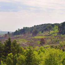
Offroad route from Branscombe to Corfe Castle along Priest Way to Worth Matravers back to Corfe and then home
- -:--
- Duration
- 93.6 km
- Distance
- 828 m
- Ascent
- 828 m
- Descent
- ---
- Avg. speed
- ---
- Avg. speed
Route quality
Waytypes & surfaces along the route
Waytypes
Quiet road
25.6 km
(27 %)
Busy road
22.4 km
(24 %)
Surfaces
Paved
63.9 km
(68 %)
Unpaved
23.4 km
(25 %)
Asphalt
63.9 km
(68 %)
Gravel
10.9 km
(12 %)
Continue with Bikemap
Use, edit, or download this cycling route
You would like to ride Core Castle to Priests Ways or customize it for your own trip? Here is what you can do with this Bikemap route:
Free features
- Save this route as favorite or in collections
- Copy & plan your own version of this route
- Sync your route with Garmin or Wahoo
Premium features
Free trial for 3 days, or one-time payment. More about Bikemap Premium.
- Navigate this route on iOS & Android
- Export a GPX / KML file of this route
- Create your custom printout (try it for free)
- Download this route for offline navigation
Discover more Premium features.
Get Bikemap PremiumFrom our community
Other popular routes starting in Bournemouth
- back from bournemouth
- Distance
- 119.5 km
- Ascent
- 242 m
- Descent
- 273 m
- Location
- Bournemouth, England, United Kingdom
- the first 50
- Distance
- 53.6 km
- Ascent
- 415 m
- Descent
- 415 m
- Location
- Bournemouth, England, United Kingdom
- Slades Farm Road - Jubilee Gardens
- Distance
- 20.6 km
- Ascent
- 142 m
- Descent
- 139 m
- Location
- Bournemouth, England, United Kingdom
- Bentley Road, Moordown to St Catherine's Hill
- Distance
- 21.2 km
- Ascent
- 141 m
- Descent
- 140 m
- Location
- Bournemouth, England, United Kingdom
- Bentley Road 4 to Bentley Road 5
- Distance
- 36.4 km
- Ascent
- 129 m
- Descent
- 126 m
- Location
- Bournemouth, England, United Kingdom
- sat route
- Distance
- 54.7 km
- Ascent
- 372 m
- Descent
- 347 m
- Location
- Bournemouth, England, United Kingdom
- Blanford Scenic Route
- Distance
- 67.9 km
- Ascent
- 490 m
- Descent
- 498 m
- Location
- Bournemouth, England, United Kingdom
- Winton to Lulworth Via Sandbanks and returning Via Swanage.
- Distance
- 86 km
- Ascent
- 717 m
- Descent
- 715 m
- Location
- Bournemouth, England, United Kingdom
Open it in the app