Aufkirch - Rott
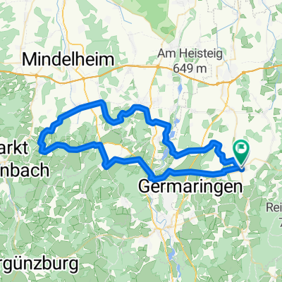
A cycling route starting in Oberostendorf, Bavaria, Germany.
Overview
About this route
über Welden -Aschthal - Denklingen - Kinsau - Apfeldorf
- -:--
- Duration
- 27.1 km
- Distance
- 268 m
- Ascent
- 277 m
- Descent
- ---
- Avg. speed
- ---
- Avg. speed
Route quality
Waytypes & surfaces along the route
Waytypes
Quiet road
15.4 km
(57 %)
Track
9.8 km
(36 %)
Surfaces
Paved
11.8 km
(43 %)
Unpaved
9.2 km
(34 %)
Asphalt
11.5 km
(42 %)
Gravel
6.1 km
(22 %)
Continue with Bikemap
Use, edit, or download this cycling route
You would like to ride Aufkirch - Rott or customize it for your own trip? Here is what you can do with this Bikemap route:
Free features
- Save this route as favorite or in collections
- Copy & plan your own version of this route
- Sync your route with Garmin or Wahoo
Premium features
Free trial for 3 days, or one-time payment. More about Bikemap Premium.
- Navigate this route on iOS & Android
- Export a GPX / KML file of this route
- Create your custom printout (try it for free)
- Download this route for offline navigation
Discover more Premium features.
Get Bikemap PremiumFrom our community
Other popular routes starting in Oberostendorf
- Erste Runde
- Distance
- 24.1 km
- Ascent
- 86 m
- Descent
- 173 m
- Location
- Oberostendorf, Bavaria, Germany
- Lengenfeld über Altensberg / Runde
- Distance
- 13.2 km
- Ascent
- 151 m
- Descent
- 160 m
- Location
- Oberostendorf, Bavaria, Germany
- Schlosspark-Radrunde 5
- Distance
- 23.6 km
- Ascent
- 79 m
- Descent
- 151 m
- Location
- Oberostendorf, Bavaria, Germany
- Am Rank 22, Oberostendorf nach Von-Kühlmann-Straße 2, Landsberg am Lech
- Distance
- 17.8 km
- Ascent
- 103 m
- Descent
- 188 m
- Location
- Oberostendorf, Bavaria, Germany
- Erste Runde
- Distance
- 24.1 km
- Ascent
- 63 m
- Descent
- 148 m
- Location
- Oberostendorf, Bavaria, Germany
- 3. Tour = Oberostendorf - Isny
- Distance
- 70.9 km
- Ascent
- 967 m
- Descent
- 871 m
- Location
- Oberostendorf, Bavaria, Germany
- Ortsstraße 2A, Kaltental nach Tannheimer Straße
- Distance
- 77.4 km
- Ascent
- 1,914 m
- Descent
- 1,471 m
- Location
- Oberostendorf, Bavaria, Germany
- Kluftinger 2.Tag
- Distance
- 63.9 km
- Ascent
- 409 m
- Descent
- 217 m
- Location
- Oberostendorf, Bavaria, Germany
Open it in the app