

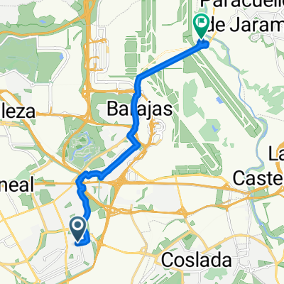
Ruta14-06-2015
A cycling route starting in San Blas-Canillejas, Madrid, Spain.
Overview
About this route
- 4 h 22 min
- Duration
- 61.8 km
- Distance
- 364 m
- Ascent
- 365 m
- Descent
- 14.1 km/h
- Avg. speed
- ---
- Max. altitude

Route highlights
Points of interest along the route

Point of interest after 2 km

Point of interest after 2 km
Continue with Bikemap
Use, edit, or download this cycling route
You would like to ride Ruta14-06-2015 or customize it for your own trip? Here is what you can do with this Bikemap route:
Free features
- Save this route as favorite or in collections
- Copy & plan your own version of this route
- Sync your route with Garmin or Wahoo
Premium features
Free trial for 3 days, or one-time payment. More about Bikemap Premium.
- Navigate this route on iOS & Android
- Export a GPX / KML file of this route
- Create your custom printout (try it for free)
- Download this route for offline navigation
Discover more Premium features.
Get Bikemap PremiumFrom our community
Other popular routes starting in San Blas-Canillejas
 Tour de Madrid
- Distance
- 62.9 km
- Ascent
- 1,765 m
- Descent
- 1,759 m
- Location
- San Blas-Canillejas, Madrid, Spain
 Paseo con Daniel
- Distance
- 21.7 km
- Ascent
- 123 m
- Descent
- 124 m
- Location
- San Blas-Canillejas, Madrid, Spain
 Ruta14-06-2015
- Distance
- 61.8 km
- Ascent
- 364 m
- Descent
- 365 m
- Location
- San Blas-Canillejas, Madrid, Spain
 Casa - Ofi
- Distance
- 2.1 km
- Ascent
- 68 m
- Descent
- 83 m
- Location
- San Blas-Canillejas, Madrid, Spain
 De Calle de Julia García Boután a Calle Miguel de Cervantes
- Distance
- 12.9 km
- Ascent
- 49 m
- Descent
- 190 m
- Location
- San Blas-Canillejas, Madrid, Spain
 Aeropuerto
- Distance
- 43.7 km
- Ascent
- 204 m
- Descent
- 204 m
- Location
- San Blas-Canillejas, Madrid, Spain
 Ruta con Angel Pasos - 18/06/2011
- Distance
- 40.7 km
- Ascent
- 354 m
- Descent
- 354 m
- Location
- San Blas-Canillejas, Madrid, Spain
 anillo ciclista madrid. este norte oeste
- Distance
- 26.8 km
- Ascent
- 191 m
- Descent
- 235 m
- Location
- San Blas-Canillejas, Madrid, Spain
Open it in the app