

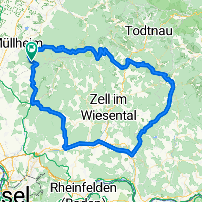
Wehratal
A cycling route starting in Feldberg, Baden-Württemberg, Germany.
Overview
About this route
viele Steigungen (etwa 2000 Hm) und schöne Aussichten in den Schwarzwald. In Schönau auf der Tunauer Straße Richtung Tunau, nach etwa 4km rechts entlang des Bachs nach Herrenschwand. Dies ist eine einsame schmale aber asphaltierte Waldstraße, die aber hier nicht als solche eingezeichnet ist.
Die einzige unpaved Strecke ist von Lipburg nach Badenweiler entlang des Rene Schickele Wegs.
- -:--
- Duration
- 103.6 km
- Distance
- 3,385 m
- Ascent
- 3,406 m
- Descent
- ---
- Avg. speed
- 1,116 m
- Max. altitude

Route quality
Waytypes & surfaces along the route
Waytypes
Busy road
63.2 km
(61 %)
Quiet road
16 km
(15 %)
Surfaces
Paved
79 km
(76 %)
Unpaved
7.1 km
(7 %)
Asphalt
78 km
(75 %)
Gravel
5.2 km
(5 %)
Continue with Bikemap
Use, edit, or download this cycling route
You would like to ride Wehratal or customize it for your own trip? Here is what you can do with this Bikemap route:
Free features
- Save this route as favorite or in collections
- Copy & plan your own version of this route
- Split it into stages to create a multi-day tour
- Sync your route with Garmin or Wahoo
Premium features
Free trial for 3 days, or one-time payment. More about Bikemap Premium.
- Navigate this route on iOS & Android
- Export a GPX / KML file of this route
- Create your custom printout (try it for free)
- Download this route for offline navigation
Discover more Premium features.
Get Bikemap PremiumFrom our community
Other popular routes starting in Feldberg
 Um den Belchen
- Distance
- 70.9 km
- Ascent
- 1,446 m
- Descent
- 1,452 m
- Location
- Feldberg, Baden-Württemberg, Germany
 RB - Lipburg to HoheBlauen 1165m
- Distance
- 28.1 km
- Ascent
- 1,639 m
- Descent
- 914 m
- Location
- Feldberg, Baden-Württemberg, Germany
 EGGENE1
- Distance
- 57.8 km
- Ascent
- 1,032 m
- Descent
- 1,032 m
- Location
- Feldberg, Baden-Württemberg, Germany
 feldberg nach halden
- Distance
- 34.3 km
- Ascent
- 1,071 m
- Descent
- 294 m
- Location
- Feldberg, Baden-Württemberg, Germany
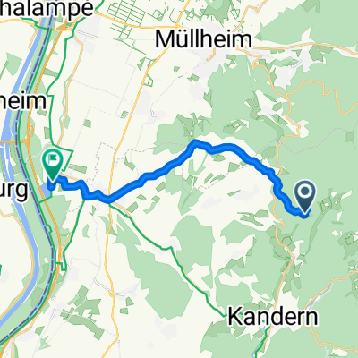
 Almenweg 2, Müllheim nach Rheintalstraße 4, Müllheim
- Distance
- 22.1 km
- Ascent
- 881 m
- Descent
- 873 m
- Location
- Feldberg, Baden-Württemberg, Germany
 Wehratal
- Distance
- 103.6 km
- Ascent
- 3,385 m
- Descent
- 3,406 m
- Location
- Feldberg, Baden-Württemberg, Germany
 Feldberg Bürgeln Blauen
- Distance
- 10.9 km
- Ascent
- 1,227 m
- Descent
- 439 m
- Location
- Feldberg, Baden-Württemberg, Germany
 High-speed route in Neuenburg am Rhein
- Distance
- 14.2 km
- Ascent
- 94 m
- Descent
- 471 m
- Location
- Feldberg, Baden-Württemberg, Germany
Open it in the app