

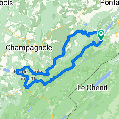
Jura Val de Mouthe
A cycling route starting in Jougne, Bourgogne-Franche-Comté, France.
Overview
About this route
Jura active
- -:--
- Duration
- 30 km
- Distance
- 429 m
- Ascent
- 430 m
- Descent
- ---
- Avg. speed
- ---
- Max. altitude

Route quality
Waytypes & surfaces along the route
Waytypes
Track
13.2 km
(44 %)
Quiet road
7.2 km
(24 %)
Surfaces
Paved
7.5 km
(25 %)
Unpaved
2.7 km
(9 %)
Asphalt
6.3 km
(21 %)
Ground
1.5 km
(5 %)
Continue with Bikemap
Use, edit, or download this cycling route
You would like to ride Jura Val de Mouthe or customize it for your own trip? Here is what you can do with this Bikemap route:
Free features
- Save this route as favorite or in collections
- Copy & plan your own version of this route
- Sync your route with Garmin or Wahoo
Premium features
Free trial for 3 days, or one-time payment. More about Bikemap Premium.
- Navigate this route on iOS & Android
- Export a GPX / KML file of this route
- Create your custom printout (try it for free)
- Download this route for offline navigation
Discover more Premium features.
Get Bikemap PremiumFrom our community
Other popular routes starting in Jougne
 Lac de Remoray-Mouthe
- Distance
- 48.4 km
- Ascent
- 723 m
- Descent
- 649 m
- Location
- Jougne, Bourgogne-Franche-Comté, France
 Remoray Lac
- Distance
- 117.8 km
- Ascent
- 1,943 m
- Descent
- 1,941 m
- Location
- Jougne, Bourgogne-Franche-Comté, France
 Grande Traversée du Jura - Etape 3 : Métabief / Les Rousses (65 km / D+ 1300 m)
- Distance
- 64.9 km
- Ascent
- 1,028 m
- Descent
- 887 m
- Location
- Jougne, Bourgogne-Franche-Comté, France
 Domingo de Manhattan
- Distance
- 62.1 km
- Ascent
- 258 m
- Descent
- 833 m
- Location
- Jougne, Bourgogne-Franche-Comté, France
 domingo
- Distance
- 73.4 km
- Ascent
- 545 m
- Descent
- 506 m
- Location
- Jougne, Bourgogne-Franche-Comté, France
 Jura Tour: Malbuisson -> Les Molunes
- Distance
- 92.2 km
- Ascent
- 1,403 m
- Descent
- 1,078 m
- Location
- Jougne, Bourgogne-Franche-Comté, France
 lac st-point tour
- Distance
- 20.1 km
- Ascent
- 177 m
- Descent
- 163 m
- Location
- Jougne, Bourgogne-Franche-Comté, France
 around Saint-point lake
- Distance
- 23.7 km
- Ascent
- 139 m
- Descent
- 122 m
- Location
- Jougne, Bourgogne-Franche-Comté, France
Open it in the app