

la diat
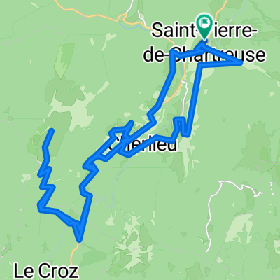
A cycling route starting in Saint-Hilaire, Auvergne-Rhône-Alpes, France.
Overview
About this route
iuhihfizuehfz
- -:--
- Duration
- 2.5 km
- Distance
- 91 m
- Ascent
- 93 m
- Descent
- ---
- Avg. speed
- ---
- Max. altitude
Route quality
Waytypes & surfaces along the route
Surfaces
Paved
1.1 km
(46 %)
Asphalt
1.1 km
(46 %)
Undefined
1.3 km
(54 %)
Route highlights
Points of interest along the route

Point of interest after 1.2 km
,,,,,,,,,,,,,,,,,,,,,,hhhhhhhhhhhhhhhhhhhhhhhhhhhhhhhhhhhhhhhhhhhhhhhhhhhhhhhhhhhhhhhhhhhhhhhhhhhhhhhhhhhhhhhhhhhhhhhhhhhhhhhhhhhhhhhhhhhhhhhhhhhhhhhhhhhhhhhhhhhhhhhhhhhhhhhhhhhhhhhhhhhhhhhhhhhhhhhhhhhhhhhhhhhhhhhhhhhhhhhhhhhhhhhhhhhhhhhhhhhhhh
Continue with Bikemap
Use, edit, or download this cycling route
You would like to ride la diat or customize it for your own trip? Here is what you can do with this Bikemap route:
Free features
- Save this route as favorite or in collections
- Copy & plan your own version of this route
- Sync your route with Garmin or Wahoo
Premium features
Free trial for 3 days, or one-time payment. More about Bikemap Premium.
- Navigate this route on iOS & Android
- Export a GPX / KML file of this route
- Create your custom printout (try it for free)
- Download this route for offline navigation
Discover more Premium features.
Get Bikemap PremiumFrom our community
Other popular routes starting in Saint-Hilaire
 22-04
22-04- Distance
- 79.9 km
- Ascent
- 2,514 m
- Descent
- 2,490 m
- Location
- Saint-Hilaire, Auvergne-Rhône-Alpes, France
 Chapelle St Bruno
- Distance
- 14.4 km
- Ascent
- 578 m
- Descent
- 573 m
- Location
- Saint-Hilaire, Auvergne-Rhône-Alpes, France
 Chartreuse 5ème
- Distance
- 80.9 km
- Ascent
- 1,634 m
- Descent
- 2,202 m
- Location
- Saint-Hilaire, Auvergne-Rhône-Alpes, France
 Tour du village
- Distance
- 1.3 km
- Ascent
- 49 m
- Descent
- 50 m
- Location
- Saint-Hilaire, Auvergne-Rhône-Alpes, France
 Auberge du Charmant Som
- Distance
- 35.4 km
- Ascent
- 980 m
- Descent
- 978 m
- Location
- Saint-Hilaire, Auvergne-Rhône-Alpes, France
 la diat
- Distance
- 2.5 km
- Ascent
- 91 m
- Descent
- 93 m
- Location
- Saint-Hilaire, Auvergne-Rhône-Alpes, France
 chartreuse
- Distance
- 38.6 km
- Ascent
- 1,278 m
- Descent
- 1,770 m
- Location
- Saint-Hilaire, Auvergne-Rhône-Alpes, France
 Chapelle St Bruno
- Distance
- 22.8 km
- Ascent
- 955 m
- Descent
- 955 m
- Location
- Saint-Hilaire, Auvergne-Rhône-Alpes, France
Open it in the app