

2015.07_Maroshévíz-Saru Rodnei-Gura Haiti-Rekettyés tető
A cycling route starting in Vale, Harghita County, Romania.
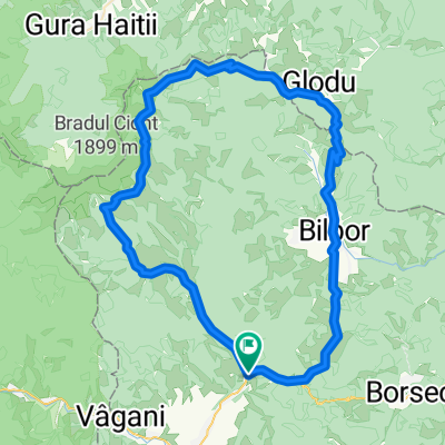
Overview
About this route
egy csodaszép útvonal
(cloned from route 3095904)
- -:--
- Duration
- 110.2 km
- Distance
- 1,827 m
- Ascent
- 1,823 m
- Descent
- ---
- Avg. speed
- ---
- Max. altitude

Route quality
Waytypes & surfaces along the route
Waytypes
Busy road
39.4 km
(36 %)
Track
24.7 km
(22 %)
Surfaces
Paved
62 km
(56 %)
Unpaved
41 km
(37 %)
Asphalt
55.8 km
(51 %)
Gravel
40.9 km
(37 %)
Continue with Bikemap
Use, edit, or download this cycling route
You would like to ride 2015.07_Maroshévíz-Saru Rodnei-Gura Haiti-Rekettyés tető or customize it for your own trip? Here is what you can do with this Bikemap route:
Free features
- Save this route as favorite or in collections
- Copy & plan your own version of this route
- Split it into stages to create a multi-day tour
- Sync your route with Garmin or Wahoo
Premium features
Free trial for 3 days, or one-time payment. More about Bikemap Premium.
- Navigate this route on iOS & Android
- Export a GPX / KML file of this route
- Create your custom printout (try it for free)
- Download this route for offline navigation
Discover more Premium features.
Get Bikemap PremiumFrom our community
Other popular routes starting in Vale
 Calimani (Lunca Bradului - Vf. Retitis - Toplita)
- Distance
- 83.1 km
- Ascent
- 1,471 m
- Descent
- 1,470 m
- Location
- Vale, Harghita County, Romania
 Toplita-Piatra Neamt
- Distance
- 126 km
- Ascent
- 813 m
- Descent
- 1,279 m
- Location
- Vale, Harghita County, Romania
 Biciklitura Marosheviz - Marosvasarhely
- Distance
- 108.8 km
- Ascent
- 38 m
- Descent
- 514 m
- Location
- Vale, Harghita County, Romania
 TURA DE O ZI IN CALIMAN
- Distance
- 72.2 km
- Ascent
- 1,309 m
- Descent
- 1,302 m
- Location
- Vale, Harghita County, Romania
 2015.08.08-11-Maroshévíz-Rekettyés-Gura Haiti-Bélbor
- Distance
- 116.5 km
- Ascent
- 1,867 m
- Descent
- 1,867 m
- Location
- Vale, Harghita County, Romania
 Toplita - Calimani - Bilbor
- Distance
- 73.9 km
- Ascent
- 1,318 m
- Descent
- 1,318 m
- Location
- Vale, Harghita County, Romania
 2015.07_Maroshévíz-Saru Rodnei-Gura Haiti-Rekettyés tető
- Distance
- 110.2 km
- Ascent
- 1,827 m
- Descent
- 1,823 m
- Location
- Vale, Harghita County, Romania
 Vale - Lacul Iezer - Vf. Rețitiș - Toplița
- Distance
- 59.4 km
- Ascent
- 1,460 m
- Descent
- 1,462 m
- Location
- Vale, Harghita County, Romania
Open it in the app