

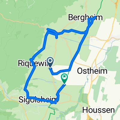
Elsass Tag 2
A cycling route starting in Riquewihr, Grand Est, France.
Overview
About this route
- -:--
- Duration
- 46.7 km
- Distance
- 1,037 m
- Ascent
- 1,037 m
- Descent
- ---
- Avg. speed
- ---
- Max. altitude
Continue with Bikemap
Use, edit, or download this cycling route
You would like to ride Elsass Tag 2 or customize it for your own trip? Here is what you can do with this Bikemap route:
Free features
- Save this route as favorite or in collections
- Copy & plan your own version of this route
- Sync your route with Garmin or Wahoo
Premium features
Free trial for 3 days, or one-time payment. More about Bikemap Premium.
- Navigate this route on iOS & Android
- Export a GPX / KML file of this route
- Create your custom printout (try it for free)
- Download this route for offline navigation
Discover more Premium features.
Get Bikemap PremiumFrom our community
Other popular routes starting in Riquewihr
 Elsass Tag 2
- Distance
- 46.7 km
- Ascent
- 1,037 m
- Descent
- 1,037 m
- Location
- Riquewihr, Grand Est, France
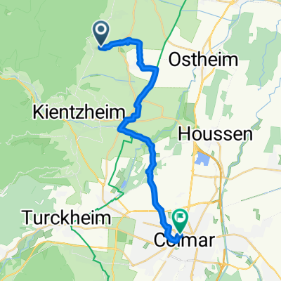
 5. Riquewihr to Osthouse
- Distance
- 60.9 km
- Ascent
- 147 m
- Descent
- 294 m
- Location
- Riquewihr, Grand Est, France
 RR-Riquwihr-Schömberg
- Distance
- 249 km
- Ascent
- 2,661 m
- Descent
- 2,243 m
- Location
- Riquewihr, Grand Est, France
 Riquwihr - Haut Koenigsbourg 2
- Distance
- 56.2 km
- Ascent
- 848 m
- Descent
- 848 m
- Location
- Riquewihr, Grand Est, France
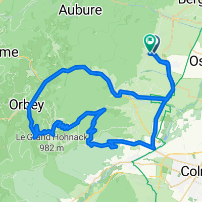
 Longinada 6
- Distance
- 76 km
- Ascent
- 1,308 m
- Descent
- 1,245 m
- Location
- Riquewihr, Grand Est, France
 Route du Vin naar Route Sans Nom
- Distance
- 31.6 km
- Ascent
- 761 m
- Descent
- 891 m
- Location
- Riquewihr, Grand Est, France
 Impasse de la Mairie, Riquewihr to Rue du Rempart, Colmar
- Distance
- 16.9 km
- Ascent
- 69 m
- Descent
- 169 m
- Location
- Riquewihr, Grand Est, France
 Riquevihr round trip
- Distance
- 56.6 km
- Ascent
- 977 m
- Descent
- 954 m
- Location
- Riquewihr, Grand Est, France
Open it in the app