

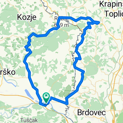
Krška vas - Goli Cirnik - Sv. Vid - Krška vas
A cycling route starting in Brežice, Občina Brežice, Slovenia.
Overview
About this route
Tura za gorsko kolo z mešanico asfaltiranih, makedamskih in single trail poti. Vključuje 2 lepa spusta in kar nekaj vzpona.
Označena pot je približna. Mogoče je kakšen obvoz zgrešen.- -:--
- Duration
- 20 km
- Distance
- 716 m
- Ascent
- 719 m
- Descent
- ---
- Avg. speed
- ---
- Max. altitude
Route quality
Waytypes & surfaces along the route
Waytypes
Track
7.4 km
(37 %)
Quiet road
7 km
(35 %)
Surfaces
Paved
1.6 km
(8 %)
Unpaved
5.8 km
(29 %)
Ground
3.8 km
(19 %)
Loose gravel
1.8 km
(9 %)
Route highlights
Points of interest along the route
Point of interest after 10.8 km
Počitek Goli Cirnik
Point of interest after 15.3 km
Sv. Vid: počitek
Continue with Bikemap
Use, edit, or download this cycling route
You would like to ride Krška vas - Goli Cirnik - Sv. Vid - Krška vas or customize it for your own trip? Here is what you can do with this Bikemap route:
Free features
- Save this route as favorite or in collections
- Copy & plan your own version of this route
- Sync your route with Garmin or Wahoo
Premium features
Free trial for 3 days, or one-time payment. More about Bikemap Premium.
- Navigate this route on iOS & Android
- Export a GPX / KML file of this route
- Create your custom printout (try it for free)
- Download this route for offline navigation
Discover more Premium features.
Get Bikemap PremiumFrom our community
Other popular routes starting in Brežice
 Route in Brezice
- Distance
- 71.6 km
- Ascent
- 1,052 m
- Descent
- 1,049 m
- Location
- Brežice, Občina Brežice, Slovenia
 Čateške toplice - Šentjernej
- Distance
- 62.5 km
- Ascent
- 591 m
- Descent
- 580 m
- Location
- Brežice, Občina Brežice, Slovenia
 Čatež-Kumrovec
- Distance
- 82.4 km
- Ascent
- 595 m
- Descent
- 594 m
- Location
- Brežice, Občina Brežice, Slovenia
 testdfsdf
- Distance
- 1.9 km
- Ascent
- 9 m
- Descent
- 4 m
- Location
- Brežice, Občina Brežice, Slovenia
 Mostec 35a to Mostec 35a
- Distance
- 14.4 km
- Ascent
- 155 m
- Descent
- 159 m
- Location
- Brežice, Občina Brežice, Slovenia
 Čatež Kumrovec
- Distance
- 70.5 km
- Ascent
- 391 m
- Descent
- 391 m
- Location
- Brežice, Občina Brežice, Slovenia
 Po Sloveniji 2010, 4. etapa, Brežice - Novo mesto
- Distance
- 163.4 km
- Ascent
- 602 m
- Descent
- 580 m
- Location
- Brežice, Občina Brežice, Slovenia
 Untitled route
- Distance
- 24 km
- Ascent
- 528 m
- Descent
- 471 m
- Location
- Brežice, Občina Brežice, Slovenia
Open it in the app