Cyklovýlet okolo Tatier 4. den
A cycling route starting in Czarny Dunajec, Lesser Poland Voivodeship, Poland.
Overview
About this route
Olda, Dřevík, Piškyn and Martin on a bike trip around the Tatras. In the morning we set off from Chochołów via Zakopane towards Morskie Oko. At Morskie Oko we get stopped because the road is closed to cyclists (even though it's fully paved). Through Ždiar we continue to Tatranská Lomnica, where we will spend the night at the Tatraniec campsite.
- -:--
- Duration
- 73.9 km
- Distance
- 1,271 m
- Ascent
- 1,247 m
- Descent
- ---
- Avg. speed
- 1,128 m
- Max. altitude
Route quality
Waytypes & surfaces along the route
Waytypes
Road
6.7 km
(9 %)
Track
3.7 km
(5 %)
Surfaces
Paved
61.3 km
(83 %)
Unpaved
5.2 km
(7 %)
Asphalt
61.3 km
(83 %)
Unpaved (undefined)
3 km
(4 %)
Continue with Bikemap
Use, edit, or download this cycling route
You would like to ride Cyklovýlet okolo Tatier 4. den or customize it for your own trip? Here is what you can do with this Bikemap route:
Free features
- Save this route as favorite or in collections
- Copy & plan your own version of this route
- Sync your route with Garmin or Wahoo
Premium features
Free trial for 3 days, or one-time payment. More about Bikemap Premium.
- Navigate this route on iOS & Android
- Export a GPX / KML file of this route
- Create your custom printout (try it for free)
- Download this route for offline navigation
Discover more Premium features.
Get Bikemap PremiumFrom our community
Other popular routes starting in Czarny Dunajec
- CHOCHOŁÓW-Dookoła Tatr 4-5-07-2015
- Distance
- 196.4 km
- Ascent
- 1,858 m
- Descent
- 1,860 m
- Location
- Czarny Dunajec, Lesser Poland Voivodeship, Poland
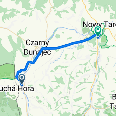
- Historicko-kultúrno-prírodná Cesta okolo Tatier, Suchá Hora do Rynek 33, Nowy Targ
- Distance
- 25 km
- Ascent
- 79 m
- Descent
- 251 m
- Location
- Czarny Dunajec, Lesser Poland Voivodeship, Poland
- Chochołów - Podczerwone placówka - Chochołów
- Distance
- 9.3 km
- Ascent
- 63 m
- Descent
- 63 m
- Location
- Czarny Dunajec, Lesser Poland Voivodeship, Poland
- Szlak wokół Tatr
- Distance
- 78.1 km
- Ascent
- 808 m
- Descent
- 808 m
- Location
- Czarny Dunajec, Lesser Poland Voivodeship, Poland
- Tour the Tatry
- Distance
- 252.7 km
- Ascent
- 1,875 m
- Descent
- 1,876 m
- Location
- Czarny Dunajec, Lesser Poland Voivodeship, Poland
- From Czarny Dunajec to Czarny Dunajec Gmina
- Distance
- 9.6 km
- Ascent
- 46 m
- Descent
- 76 m
- Location
- Czarny Dunajec, Lesser Poland Voivodeship, Poland
- Wokół Tatr - WOPR
- Distance
- 268.5 km
- Ascent
- 1,703 m
- Descent
- 1,710 m
- Location
- Czarny Dunajec, Lesser Poland Voivodeship, Poland
- Dookoła Tatr
- Distance
- 217.9 km
- Ascent
- 1,995 m
- Descent
- 1,998 m
- Location
- Czarny Dunajec, Lesser Poland Voivodeship, Poland
Open it in the app