
LYON BALLADE
A cycling route starting in La Mulatière, Auvergne-Rhône-Alpes, France.
Overview
About this route
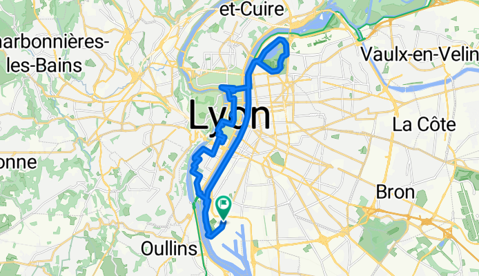
Discovery of Lyon from Parc Gerland, Confluence, Bellecour, Terreaux, Parc Tête d'Or and back to the banks.
- -:--
- Duration
- 25.1 km
- Distance
- 47 m
- Ascent
- 48 m
- Descent
- ---
- Avg. speed
- ---
- Max. altitude
Route quality
Waytypes & surfaces along the route
Waytypes
Cycleway
9.5 km
(38 %)
Pedestrian area
7 km
(28 %)
Surfaces
Paved
21.6 km
(86 %)
Unpaved
2.3 km
(9 %)
Asphalt
18.8 km
(75 %)
Concrete
2.8 km
(11 %)
Route highlights
Points of interest along the route
Point of interest after 8.4 km
statue Saint EXUPERY
Point of interest after 8.5 km
statue Louis XIV
Point of interest after 11.6 km
statue Bartholdi
Continue with Bikemap
Use, edit, or download this cycling route
You would like to ride LYON BALLADE or customize it for your own trip? Here is what you can do with this Bikemap route:
Free features
- Save this route as favorite or in collections
- Copy & plan your own version of this route
- Sync your route with Garmin or Wahoo
Premium features
Free trial for 3 days, or one-time payment. More about Bikemap Premium.
- Navigate this route on iOS & Android
- Export a GPX / KML file of this route
- Create your custom printout (try it for free)
- Download this route for offline navigation
Discover more Premium features.
Get Bikemap PremiumFrom our community
Other popular routes starting in La Mulatière
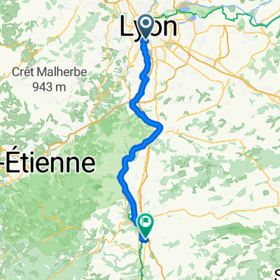
 F 610: Lyon - Vienne - Lyon
- Distance
- 70.8 km
- Ascent
- 415 m
- Descent
- 413 m
- Location
- La Mulatière, Auvergne-Rhône-Alpes, France
 Route stable en Lyon
- Distance
- 10.3 km
- Ascent
- 16 m
- Descent
- 16 m
- Location
- La Mulatière, Auvergne-Rhône-Alpes, France
 Lyon-Cassis
- Distance
- 426.4 km
- Ascent
- 1,326 m
- Descent
- 1,182 m
- Location
- La Mulatière, Auvergne-Rhône-Alpes, France
 september day1
- Distance
- 68.6 km
- Ascent
- 28 m
- Descent
- 59 m
- Location
- La Mulatière, Auvergne-Rhône-Alpes, France
 Lyon - Saint Rambert-d'Albon
- Distance
- 73 km
- Ascent
- 382 m
- Descent
- 394 m
- Location
- La Mulatière, Auvergne-Rhône-Alpes, France
 Itinéraire facile en Lyon
- Distance
- 29.6 km
- Ascent
- 53 m
- Descent
- 54 m
- Location
- La Mulatière, Auvergne-Rhône-Alpes, France
 LYON BALLADE
- Distance
- 25.1 km
- Ascent
- 47 m
- Descent
- 48 m
- Location
- La Mulatière, Auvergne-Rhône-Alpes, France
 Testing Testing
- Distance
- 14.5 km
- Ascent
- 307 m
- Descent
- 98 m
- Location
- La Mulatière, Auvergne-Rhône-Alpes, France
Open it in the app