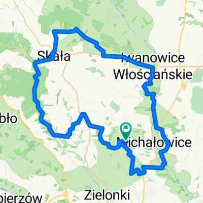
Krak贸w-Batowice-Dziekanowice
A cycling route starting in Micha艂owice, Lesser Poland Voivodeship, Poland.
Overview
About this route
The trail starts at the blue trail no. 14 of the D艂ubnia Valley, running along Jeziorany Street in Krakow. However, it's simpler and shorter to reach from the Mistrzejowice Housing Estate via Mistrzejowicka Street to G. Morcinka Street, turning left after the railway viaduct onto the paved road. From the borders of the Zielonki Municipality, you ride already on asphalt to the north along the reservoir on the D艂ubnia in Zes艂awice. The trail leads through Batowice to Dziekanowice, where other cycling routes intersect.
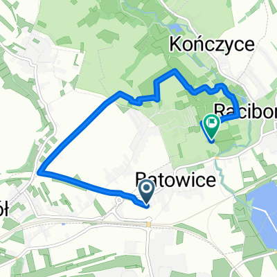
- -:--
- Duration
- 3.5 km
- Distance
- 48 m
- Ascent
- 4 m
- Descent
- ---
- Avg. speed
- ---
- Max. altitude
Route quality
Waytypes & surfaces along the route
Waytypes
Quiet road
2.5 km
(71 %)
Road
1 km
(29 %)
Surfaces
Paved
3.5 km
(100 %)
Asphalt
3.5 km
(100 %)
Route highlights
Points of interest along the route
Point of interest after 2.9 km
Kapliczka w Batowicach
Continue with Bikemap
Use, edit, or download this cycling route
You would like to ride Krak贸w-Batowice-Dziekanowice or customize it for your own trip? Here is what you can do with this Bikemap route:
Free features
- Save this route as favorite or in collections
- Copy & plan your own version of this route
- Sync your route with Garmin or Wahoo
Premium features
Free trial for 3 days, or one-time payment. More about Bikemap Premium.
- Navigate this route on iOS & Android
- Export a GPX / KML file of this route
- Create your custom printout (try it for free)
- Download this route for offline navigation
Discover more Premium features.
Get Bikemap PremiumFrom our community
Other popular routes starting in Micha艂owice
- BA艁KANY17
- Distance
- 3,523.4 km
- Ascent
- 6,912 m
- Descent
- 7,015 m
- Location
- Micha艂owice, Lesser Poland Voivodeship, Poland
- Recording from 29 sierpnia, 10:02
- Distance
- 42.3 km
- Ascent
- 351 m
- Descent
- 350 m
- Location
- Micha艂owice, Lesser Poland Voivodeship, Poland
- KRK: NH -> Ojc贸w -> B臋dkowska -> Kleszcz贸w -> Mydlniki -> NH
- Distance
- 81.8 km
- Ascent
- 548 m
- Descent
- 548 m
- Location
- Micha艂owice, Lesser Poland Voivodeship, Poland
- osada jurajska
- Distance
- 27.1 km
- Ascent
- 157 m
- Descent
- 175 m
- Location
- Micha艂owice, Lesser Poland Voivodeship, Poland
- Bibice d艂ubnia
- Distance
- 20.4 km
- Ascent
- 205 m
- Descent
- 208 m
- Location
- Micha艂owice, Lesser Poland Voivodeship, Poland
- Zielona trasa rowerowa
- Distance
- 22.5 km
- Ascent
- 269 m
- Descent
- 269 m
- Location
- Micha艂owice, Lesser Poland Voivodeship, Poland
- Petla marszowiecka
- Distance
- 7.4 km
- Ascent
- 87 m
- Descent
- 87 m
- Location
- Micha艂owice, Lesser Poland Voivodeship, Poland
- 8 Dolin膮 D艂ubni - Jura i Wy偶yna Miechowska
- Distance
- 46.6 km
- Ascent
- 328 m
- Descent
- 327 m
- Location
- Micha艂owice, Lesser Poland Voivodeship, Poland
Open it in the app