

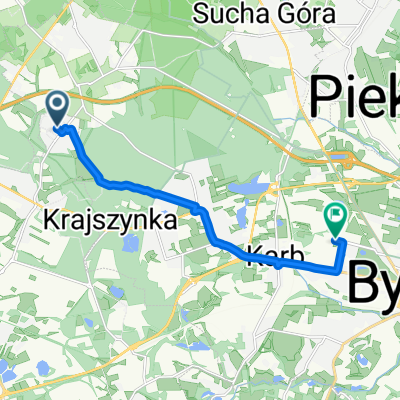
Bytom - Wielowieś
A cycling route starting in Wieszowa, Silesian Voivodeship, Poland.
Overview
About this route
Through the Park in Reptach - once with the beautiful Donnersmarck palace, burned by the known authorities in 1945 and then blown up and completely demolished by the same authorities in 1966. To this day, only the remodeled horse stable and the park from the old palace and park complex have survived, and a rehabilitation center has also been built nearby. In the park, you can also visit the Black Trout Mine - 600 m in boats through the flooded mine - amazing experiences. Further on, through Laryszów, I head to Miedary to see the palace, which currently houses the Social Assistance Home. But the windows look somewhat empty. From Miedary through Połomnia and Wojska, I reach Wielowieś. At the tourist map - wondering where to go next - an older gentleman strikes up a conversation with me, who turns out to be a tour guide. A half-hour chat convinces me that there will definitely be a stage II in this area. I visit the first of the mentioned - the synagogue remodeled during World War II into a grain warehouse (and it has remained so even though it seems that it is no longer used), the evangelical church, and the palace which currently houses the institutions of the Wielowieś commune. From Wielowieś, I head to Sieroty with another church of the wooden architecture trail. Then I go to the village of Chwoszcz and, through Księży Las and Zbrosławice, I return home.
- -:--
- Duration
- 65.9 km
- Distance
- 269 m
- Ascent
- 265 m
- Descent
- ---
- Avg. speed
- ---
- Max. altitude

Route quality
Waytypes & surfaces along the route
Waytypes
Road
49.4 km
(75 %)
Quiet road
8.6 km
(13 %)
Surfaces
Paved
42.2 km
(64 %)
Unpaved
1.3 km
(2 %)
Asphalt
42.2 km
(64 %)
Gravel
0.7 km
(1 %)
Continue with Bikemap
Use, edit, or download this cycling route
You would like to ride Bytom - Wielowieś or customize it for your own trip? Here is what you can do with this Bikemap route:
Free features
- Save this route as favorite or in collections
- Copy & plan your own version of this route
- Sync your route with Garmin or Wahoo
Premium features
Free trial for 3 days, or one-time payment. More about Bikemap Premium.
- Navigate this route on iOS & Android
- Export a GPX / KML file of this route
- Create your custom printout (try it for free)
- Download this route for offline navigation
Discover more Premium features.
Get Bikemap PremiumFrom our community
Other popular routes starting in Wieszowa
 Bolesława Prusa do Piłkarska
- Distance
- 10 km
- Ascent
- 84 m
- Descent
- 135 m
- Location
- Wieszowa, Silesian Voivodeship, Poland
 Recovered Route
- Distance
- 18.8 km
- Ascent
- 494 m
- Descent
- 518 m
- Location
- Wieszowa, Silesian Voivodeship, Poland
 Helenka-Ziemięcice-Gliwice-Kleszczów-Helenka
- Distance
- 61.4 km
- Ascent
- 196 m
- Descent
- 196 m
- Location
- Wieszowa, Silesian Voivodeship, Poland
 Bolesława Prusa do Piłkarska
- Distance
- 9.9 km
- Ascent
- 88 m
- Descent
- 94 m
- Location
- Wieszowa, Silesian Voivodeship, Poland
 Niedziela 1
- Distance
- 58.3 km
- Ascent
- 222 m
- Descent
- 222 m
- Location
- Wieszowa, Silesian Voivodeship, Poland
 Niby góry, czyli rekonesans z przyczepką
- Distance
- 20.3 km
- Ascent
- 170 m
- Descent
- 170 m
- Location
- Wieszowa, Silesian Voivodeship, Poland
 Helenka-Ziemięcice-Gliwice-Kleszczów-Pyskowice-Helenka
- Distance
- 60.3 km
- Ascent
- 223 m
- Descent
- 224 m
- Location
- Wieszowa, Silesian Voivodeship, Poland
 Helenka-Gliwice-Bierawa-Anna berg x3-Bierawa-Gliwice-Helenka
- Distance
- 215.1 km
- Ascent
- 651 m
- Descent
- 651 m
- Location
- Wieszowa, Silesian Voivodeship, Poland
Open it in the app