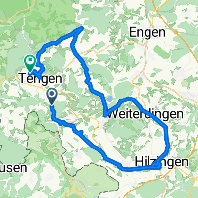
Schaffhausen Nord- Corso
A cycling route starting in Tengen, Baden-Württemberg, Germany.
Overview
About this route
Rennrad Corso im Norden Schaffhausens
- -:--
- Duration
- 75.8 km
- Distance
- 1,207 m
- Ascent
- 1,248 m
- Descent
- ---
- Avg. speed
- ---
- Avg. speed
Route quality
Waytypes & surfaces along the route
Waytypes
Road
47.3 km
(62 %)
Quiet road
12.4 km
(16 %)
Surfaces
Paved
55.6 km
(73 %)
Unpaved
3.8 km
(5 %)
Asphalt
55.4 km
(73 %)
Gravel
2.1 km
(3 %)
Continue with Bikemap
Use, edit, or download this cycling route
You would like to ride Schaffhausen Nord- Corso or customize it for your own trip? Here is what you can do with this Bikemap route:
Free features
- Save this route as favorite or in collections
- Copy & plan your own version of this route
- Sync your route with Garmin or Wahoo
Premium features
Free trial for 3 days, or one-time payment. More about Bikemap Premium.
- Navigate this route on iOS & Android
- Export a GPX / KML file of this route
- Create your custom printout (try it for free)
- Download this route for offline navigation
Discover more Premium features.
Get Bikemap PremiumFrom our community
Other popular routes starting in Tengen
- Rundfahrt Tengen-Thayngen
- Distance
- 26.3 km
- Ascent
- 307 m
- Descent
- 308 m
- Location
- Tengen, Baden-Württemberg, Germany
- Tour zum Kandel
- Distance
- 192.6 km
- Ascent
- 2,000 m
- Descent
- 2,000 m
- Location
- Tengen, Baden-Württemberg, Germany
- Immendingen- Tengen und zurück
- Distance
- 46.7 km
- Ascent
- 566 m
- Descent
- 567 m
- Location
- Tengen, Baden-Württemberg, Germany
- 2. Hegau 28 km
- Distance
- 14.3 km
- Ascent
- 145 m
- Descent
- 435 m
- Location
- Tengen, Baden-Württemberg, Germany
- 2010-4-Riedöschingen-Donaueschingen-Mühlheim
- Distance
- 68.2 km
- Ascent
- 164 m
- Descent
- 211 m
- Location
- Tengen, Baden-Württemberg, Germany
- Schaffhausen Nord- Corso
- Distance
- 75.8 km
- Ascent
- 1,207 m
- Descent
- 1,248 m
- Location
- Tengen, Baden-Württemberg, Germany
- Donaueschlingen
- Distance
- 76.1 km
- Ascent
- 958 m
- Descent
- 963 m
- Location
- Tengen, Baden-Württemberg, Germany
- Grenz-Hegau-Tour-1993
- Distance
- 56 km
- Ascent
- 1,042 m
- Descent
- 1,042 m
- Location
- Tengen, Baden-Württemberg, Germany
Open it in the app