

2015_tt_e6_
A cycling route starting in Engelberg, Canton of Obwalden, Switzerland.
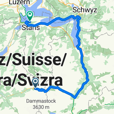
Overview
About this route
TORTOUR 2015 ETAPPE 6 Sustenpass - Interlaken (cloned from route 2927262)
- -:--
- Duration
- 65.4 km
- Distance
- 184 m
- Ascent
- 1,831 m
- Descent
- ---
- Avg. speed
- ---
- Max. altitude

Route quality
Waytypes & surfaces along the route
Waytypes
Quiet road
5.2 km
(8 %)
Access road
1.3 km
(2 %)
Surfaces
Paved
55.6 km
(85 %)
Unpaved
0.7 km
(1 %)
Asphalt
55.6 km
(85 %)
Unpaved (undefined)
0.7 km
(1 %)
Undefined
9.2 km
(14 %)
Continue with Bikemap
Use, edit, or download this cycling route
You would like to ride 2015_tt_e6_ or customize it for your own trip? Here is what you can do with this Bikemap route:
Free features
- Save this route as favorite or in collections
- Copy & plan your own version of this route
- Sync your route with Garmin or Wahoo
Premium features
Free trial for 3 days, or one-time payment. More about Bikemap Premium.
- Navigate this route on iOS & Android
- Export a GPX / KML file of this route
- Create your custom printout (try it for free)
- Download this route for offline navigation
Discover more Premium features.
Get Bikemap PremiumFrom our community
Other popular routes starting in Engelberg
 Engelberg - Stansstad
- Distance
- 99.7 km
- Ascent
- 3,172 m
- Descent
- 4,021 m
- Location
- Engelberg, Canton of Obwalden, Switzerland
 Jochpass-Schwarzental-Jochpass-Engelberg
- Distance
- 27.1 km
- Ascent
- 913 m
- Descent
- 2,092 m
- Location
- Engelberg, Canton of Obwalden, Switzerland
 Tag_3_-_ZZ_Transalp_Engstlenalp_-_Interlaken
- Distance
- 58.2 km
- Ascent
- 870 m
- Descent
- 2,146 m
- Location
- Engelberg, Canton of Obwalden, Switzerland
 TORTOUR TS08-TS09
- Distance
- 110.5 km
- Ascent
- 1,520 m
- Descent
- 3,091 m
- Location
- Engelberg, Canton of Obwalden, Switzerland
 Jochpass - Interlaken
- Distance
- 85.2 km
- Ascent
- 2,476 m
- Descent
- 4,113 m
- Location
- Engelberg, Canton of Obwalden, Switzerland
 Wanderung Engelberg - Stäfeli
- Distance
- 10.2 km
- Ascent
- 783 m
- Descent
- 782 m
- Location
- Engelberg, Canton of Obwalden, Switzerland
 06 Sustenpass - Sachseln
- Distance
- 60.2 km
- Ascent
- 489 m
- Descent
- 2,237 m
- Location
- Engelberg, Canton of Obwalden, Switzerland
 Pässetour Öpfelchasper Etappe 3 einfach
- Distance
- 72.7 km
- Ascent
- 2,198 m
- Descent
- 1,900 m
- Location
- Engelberg, Canton of Obwalden, Switzerland
Open it in the app