

Tour de France 2015 - Stage 11
A cycling route starting in Pau, Nouvelle-Aquitaine, France.
Overview
About this route
Mercredi 15 juillet
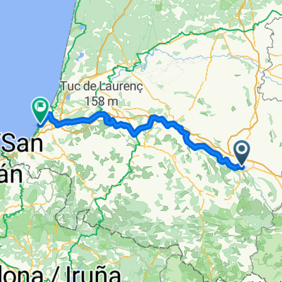
Pau / Cauterets - Vallée de Saint-Savin 188 km- -:--
- Duration
- 197.5 km
- Distance
- 3,071 m
- Ascent
- 2,369 m
- Descent
- ---
- Avg. speed
- ---
- Max. altitude
Route quality
Waytypes & surfaces along the route
Waytypes
Quiet road
19.7 km
(10 %)
Road
7.9 km
(4 %)
Surfaces
Paved
152.1 km
(77 %)
Unpaved
3.9 km
(2 %)
Asphalt
152.1 km
(77 %)
Gravel
2 km
(1 %)
Route highlights
Points of interest along the route
Point of interest after 10.1 km
Km 0
Point of interest after 59 km
Côte de Loucrup Côte de 3ème catégorie. Altitude : 530 m. Distance : 2 km. Pente : 7,3 %
Point of interest after 67.4 km
Sprint
Point of interest after 71.9 km
Côte de Bagnères-de-Bigorre Côte de 4ème catégorie. Altitude : 644 m. Distance : 1,4 km. Pente : 6,1 %
Point of interest after 85.8 km
Côte de Mauvezin Côte de 3ème catégorie. Altitude : 501 m. Distance : 2,7 km. Pente : 6 %
Point of interest after 126.7 km
Col d'Aspin (1 490 m) Col d'Aspin" à droite. Col de 1ère catégorie. Altitude : 1490 m. Distance : 12 km. Pente : 6,4 %
Point of interest after 156.5 km
Col du Tourmalet (2 115 m) Souvenir Jacques Goddet Col hors-catégorie. Altitude : 2115 m. Distance : 16,9 km. Pente : 7,4 %
Point of interest after 194.3 km
Côte de Cauterets Côte de 3ème catégorie. Altitude : 817 m. Distance : 6,4 km. Pente : 5 %
Continue with Bikemap
Use, edit, or download this cycling route
You would like to ride Tour de France 2015 - Stage 11 or customize it for your own trip? Here is what you can do with this Bikemap route:
Free features
- Save this route as favorite or in collections
- Copy & plan your own version of this route
- Split it into stages to create a multi-day tour
- Sync your route with Garmin or Wahoo
Premium features
Free trial for 3 days, or one-time payment. More about Bikemap Premium.
- Navigate this route on iOS & Android
- Export a GPX / KML file of this route
- Create your custom printout (try it for free)
- Download this route for offline navigation
Discover more Premium features.
Get Bikemap PremiumFrom our community
Other popular routes starting in Pau
 17. Samatan / Pau
- Distance
- 200.3 km
- Ascent
- 4,523 m
- Descent
- 4,113 m
- Location
- Pau, Nouvelle-Aquitaine, France
 Von Pau bis Biarritz
- Distance
- 148.8 km
- Ascent
- 1,132 m
- Descent
- 1,294 m
- Location
- Pau, Nouvelle-Aquitaine, France
 De Place Georges Clemenceau à Place Mulot
- Distance
- 12.3 km
- Ascent
- 50 m
- Descent
- 121 m
- Location
- Pau, Nouvelle-Aquitaine, France
 Ride Day 7—15 Sept 2005—64000 Pau to 64400 Oloron-Ste-Marie
- Distance
- 103.4 km
- Ascent
- 824 m
- Descent
- 806 m
- Location
- Pau, Nouvelle-Aquitaine, France
 My tdf etape 11
- Distance
- 176.6 km
- Ascent
- 4,014 m
- Descent
- 2,450 m
- Location
- Pau, Nouvelle-Aquitaine, France
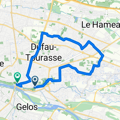
 De Boulevard Tourasse 38, Pau à Rue Berlioz 7, Pau
- Distance
- 22.3 km
- Ascent
- 394 m
- Descent
- 441 m
- Location
- Pau, Nouvelle-Aquitaine, France
 Tour de France 2015 - Stage 11
- Distance
- 197.5 km
- Ascent
- 3,071 m
- Descent
- 2,369 m
- Location
- Pau, Nouvelle-Aquitaine, France
 ballade soir niv1
- Distance
- 43.1 km
- Ascent
- 131 m
- Descent
- 130 m
- Location
- Pau, Nouvelle-Aquitaine, France
Open it in the app