

Bahntrassen Sprockhövel-Kemnader See-
A cycling route starting in Sprockhövel, North Rhine-Westphalia, Germany.
Overview
About this route
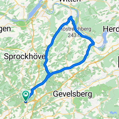
wir beginnen unsere Tour am alten Bahnhof Schee. Hier gib es einen Parkplatz im Rottenberger Weg.
Wir folgen dem Track in Richtung Witten / Kemnader See / Hattingen und wieder zurück zum Bahnhof Schee.- -:--
- Duration
- 51.6 km
- Distance
- 287 m
- Ascent
- 287 m
- Descent
- ---
- Avg. speed
- ---
- Max. altitude

Route quality
Waytypes & surfaces along the route
Waytypes
Path
27.1 km
(53 %)
Quiet road
7.9 km
(15 %)
Surfaces
Paved
30.2 km
(58 %)
Unpaved
21.1 km
(41 %)
Asphalt
24.8 km
(48 %)
Gravel
15.9 km
(31 %)
Continue with Bikemap
Use, edit, or download this cycling route
You would like to ride Bahntrassen Sprockhövel-Kemnader See- or customize it for your own trip? Here is what you can do with this Bikemap route:
Free features
- Save this route as favorite or in collections
- Copy & plan your own version of this route
- Sync your route with Garmin or Wahoo
Premium features
Free trial for 3 days, or one-time payment. More about Bikemap Premium.
- Navigate this route on iOS & Android
- Export a GPX / KML file of this route
- Create your custom printout (try it for free)
- Download this route for offline navigation
Discover more Premium features.
Get Bikemap PremiumFrom our community
Other popular routes starting in Sprockhövel
 68 Km - Sprockhövel - Baldeneysee
- Distance
- 68.5 km
- Ascent
- 226 m
- Descent
- 224 m
- Location
- Sprockhövel, North Rhine-Westphalia, Germany
 Von Ruhr zur Ruhr
- Distance
- 56.9 km
- Ascent
- 315 m
- Descent
- 314 m
- Location
- Sprockhövel, North Rhine-Westphalia, Germany
 Schöne Feierabendrunde
- Distance
- 33.5 km
- Ascent
- 320 m
- Descent
- 349 m
- Location
- Sprockhövel, North Rhine-Westphalia, Germany
 Haßlinghausen - Herdecke
- Distance
- 44.8 km
- Ascent
- 348 m
- Descent
- 350 m
- Location
- Sprockhövel, North Rhine-Westphalia, Germany
 Von Sprockhövel bis Hattingen
- Distance
- 22 km
- Ascent
- 341 m
- Descent
- 445 m
- Location
- Sprockhövel, North Rhine-Westphalia, Germany
 Elfringhauser Schweiz
- Distance
- 23.4 km
- Ascent
- 308 m
- Descent
- 307 m
- Location
- Sprockhövel, North Rhine-Westphalia, Germany
 Von Ruhr zur Ruhr ab Langerfeld
- Distance
- 72 km
- Ascent
- 452 m
- Descent
- 452 m
- Location
- Sprockhövel, North Rhine-Westphalia, Germany
 Erkundungsfahrt Hasslinghausen - Sprockhövel
- Distance
- 18 km
- Ascent
- 157 m
- Descent
- 172 m
- Location
- Sprockhövel, North Rhine-Westphalia, Germany
Open it in the app